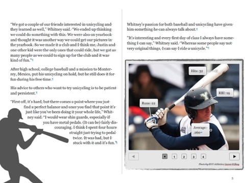
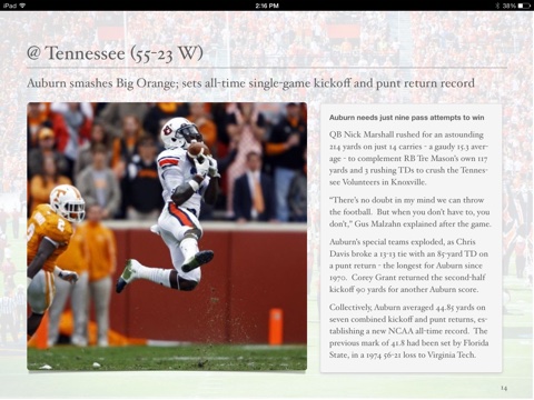
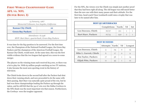
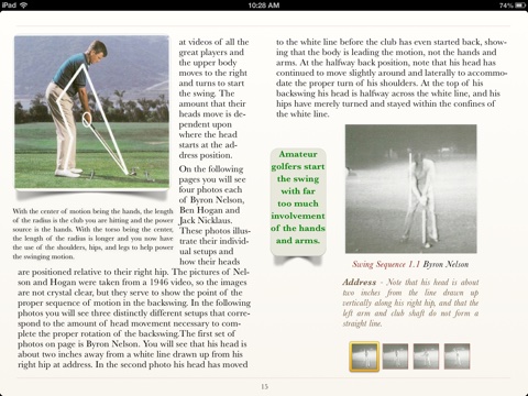
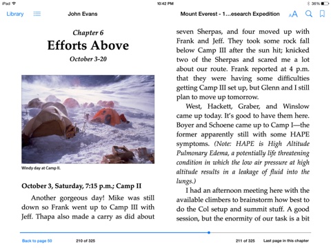
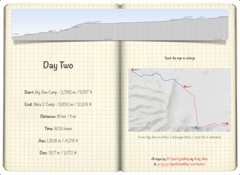
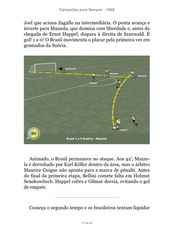
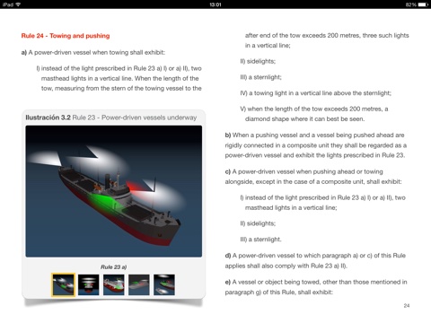
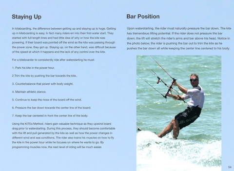
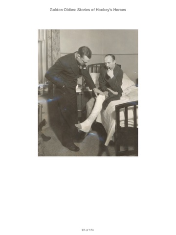
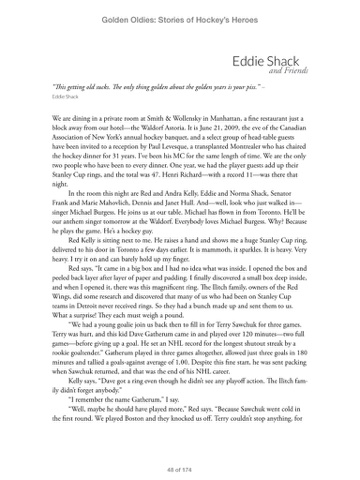
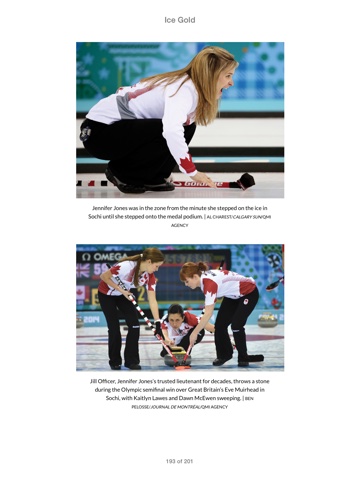
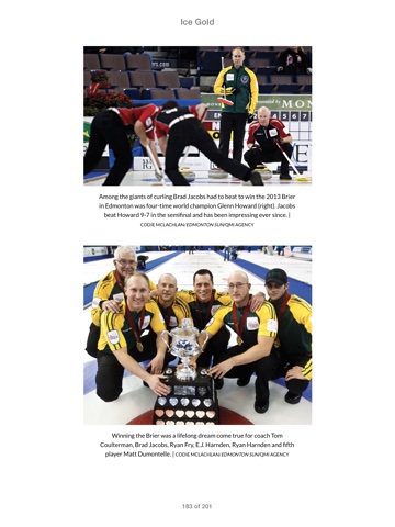
Mustaches and Mayhem: Charlie O's Three Time Champions: The Oakland Athletics: 1972-74
In modern baseball history, only one team not named the New York Yankees has ever won three consecutive World Series. That team was the Oakland Athletics, who captured major league baseball’s crown each year from 1972 through 1974.
Led by such superstars as future Hall of Famers Reggie Jackson, Catfish Hunter and Rollie Fingers, in the final years before free agency and the movement of playersfrom one team to another forever changed the game, the Athletics were a largely homegrown aggregate of players who joined the organization when the team called Kansas City its home, developed as teammates in the minor leagues, and came of age together in Oakland.
But it was the way in which they did it that immortalized those teams. For if the story of the Oakland Athletics’ championships is that of one of baseball’s greatest teams, it’s also the story of enigmatic owner Charles O. Finley and how those players succeeded in spite of Finley’s larger-than-life persona and meddlesome ways. Indeed, before the Yankees’ George Steinbrenner, there was Charles Oscar Finley, of the Athletics.
Featuring the contributions of 46 members of the Society for American Baseball Research (SABR), Mustaches and Mayhem: Charlie O’s Three-Time Champions shares the stories of each of the roster players on each of the A’s championship teams, in addition to the managers, coaches, Finley himself, the team’s radio announcer, and even Charlie O, the mule, Finley’s legendary mascot. Summaries of each spring training and World Series, too, will complete the tale of one of baseball’s most colorful and successful teams.
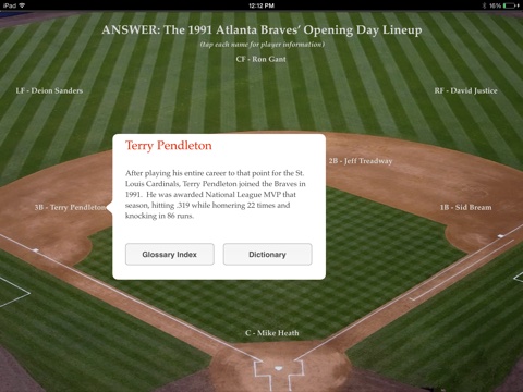
Biographies included: Charlie Finley, Charlie O (the Mule), Sal Bando, Vida Blue, Bert Campaneris, Rollie Fingers, Dick Green, Dave Hamilton, Catfish Hunter, Reggie Jackson, Ted Kubiak, Blue Moon Odom, Joe Rudi, Gene Tenace, Jerry Adair (coach), Matty Alou, Brant Alyea, Dwain Anderson, Curt Blefary, Bob Brooks, Larry Brown, Ollie Brown, Orlando Cepeda, Ron Clark, Tim Cullen, Dave Duncan, Mike Epstein, Adrian Garrett, Larry Haney, Mike Hegan, George Hendrick, Ken Holtzman, Joe Horlen, Vern Hoscheit (coach), Mike Kilkenny, Darold Knowles, Allan Lewis, Bob Locker, Angel Mangual, Gonzalo Marques, Marty Martinez, Dal Maxvill, Denny McLain, Bill McNulty, Don Mincher, Irv Noren (coach), Bill Posedel (coach), Jim Roland, Diego Segui, Art Shamsky, Don Shaw, Bill Voss, Gary Waslewski, Dick Williams, Glenn Abbott, Jesus Alou, Mike Andrews, Pat Bourque, Rico Carty, Billy Conigliaro, Vic Davalillo, Chuck Dobson, Ray Fosse, Rob Gardner, Phil Garner, Tim Hosley, Deron Johnson, Jay Johnstone, Paul Lindblad, Rich McKinney, Jose Morales, Bill North, Horacio Pina, Wes Stock (coach), Manny Trillo, Alvin Dark, John Donaldson, Bob Hofman, Jim Holt, Leon Hooten, Bill Parsons, Gaylen Pitts, Champ Summers, Claudell Washington, Herb Washington, Bob Winkles, and Monte Moore (broadcaster).
With contributions from SABR members Alan Cohen, Andy Sturgill, Austin Gisriel, Bill Nowlin, Charlie O’Reilly, Chip Greene, Clayton Trutor, Clifford Corn, Curt Smith, Dale Voiss, Eric Aron, Francisco Rodriguez Lozano, Geoffrey Dunn, Greg Erion, Gregory H. Wolf, J.G. Preston, Jeff English, Jimmy Keenan, Joanne Hulbert, Joe Wancho, John Cizik, John Henshell, John Vorperian, Joseph Gerard, Keith Scherer, Leonte Landino, Loretta Donovan, Marc Z Aaron, Mark Armour, Matt Bohn, Matthew Silverman, Maxwell Kates, Mike Epstein, Neal Poloncarz, Norm King, Paul Hofmann, Richard J. Puerzer, Rick Schabowski, Rory Costello, Royse Parr, Saul Wisnia, Scott Ferkovich, Ted Leavengood, Thomas Ayers, Tim Herlich, Tom Hawthorn, and Wynn Montgomery.