Flip to back
Flip to front

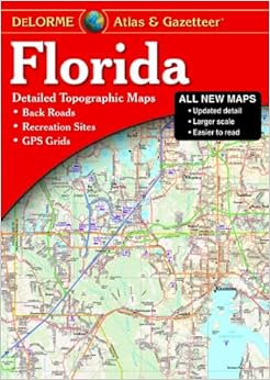
Florida Atlas & Gazetteer (Delorme Atlas & Gazetteer) Perfect Paperback – September 7, 2012
$22.06
FREE Shipping on orders over $35.
In Stock.
Ships from and sold by Amazon.com.
Gift-wrap available.
NO_CONTENT_IN_FEATURE
Tell the Publisher!
I'd like to read this book on Kindle
Don't have a Kindle? Get your Kindle here, or download a FREE Kindle Reading App.
I'd like to read this book on Kindle
Don't have a Kindle? Get your Kindle here, or download a FREE Kindle Reading App.

Want to know our Editors' picks for the best books of the month? Browse Best Books of the Month, featuring our favorite new books in more than a dozen categories.
Product Details
Would you like to update product info or give feedback on images?.
|
Customer Reviews
Most Helpful Customer Reviews
10 of 10 people found the following review helpful
By
Christopher Bessert
on October 16, 2012
The new 10th Edition of the Florida Atlas & Gazetteer not only features completely new (redrawn) maps, they actually INCREASED the scale of the mapping as well! In the 1st through 9th Editions, the maps were at a scale of 1:150,000 which isn't all that bad. The newly redrawn 10th Edition atlas maps are at 1:120,000! In this day and age where things get cheaper and lower quality (including maps), this is a surprising improvement! I don't think I've ever seen a time where a new edition of an atlas/map was issued with MORE detail at a higher level of resolution! With the larger scale, more local roads are labeled and it's easier to read the maps in general.
As the previous editions had been reissued and "updated," there were some complaints about the quality and quantity of the updates. With such rampant development as Florida has seen over the past two decades since the first DeLorme atlas of the state was published, quite a few newer developments, freeway interchanges, and streets were not added, although most of the major new highways, freeways and toll roads generally made it in. This is the first all-digital DeLorme atlas of Florida and uses up-to-date data. I've only been flipping through it for a little bit now, but a LOT of the new developments are included. For example, The Villages (near Lady Lake northwest of Orlando) is a HUGE new development and it looks like the entire thing is on the maps now. All the latest segments of toll roads in the Orlando area are included as well.
The only downside with the new 10th Edition is that it's now a bound volume instead of being stapled. The stapled versions do tend to fall apart easier with heavy usage, but you're also able to fold them back on themselves while using them int he car.Read more ›
Thank you for your feedback.
If this review is inappropriate, please let us know.
Sorry, we failed to record your vote. Please try again
6 of 6 people found the following review helpful
By
Amazon Customer
on September 5, 2013
Verified Purchase
Comment
Sending feedback...
Grid map make it a very easy for you to locate the area you need to go! All back roads, off road camping, campgrounds and more are at your fingertips. My husband and I live in our RV full time and we have learned to put our trust in this collection of maps. One suggestion to Delorme Publishing though.... we would be willing to spend a few extra $$$ if you would also make this available with a spiral spine (notebook) design similar to what Rand McNally offers. It is really nice to be able to lay it flat to read and keep it open to the page you want!
Thank you for your feedback.
If this review is inappropriate, please let us know.
Sorry, we failed to record your vote. Please try again
3 of 3 people found the following review helpful
By
Regular customer
on February 13, 2014
Verified Purchase
Comment
Sending feedback...
Fragile - this atlas is not ideal for practical use. The pages are glued to the binding unlike the centerfold staple design of previous editions. The atlas began falling apart after a few months and now most of the pages are loose. This is especially problematic when I want to changes pages or move to a different section of the atlas - it's like sorting through a stack of individual sheets rather than turning pages.
I'M HAPPY WITH THE CONTENT, but hate the binding. I stopped looking for a print shop that would coil bind it (I contacted more than a dozen) and am trying to come up with a way to keep the thing together.
DeLorme - please fix this. Thank you.
I'M HAPPY WITH THE CONTENT, but hate the binding. I stopped looking for a print shop that would coil bind it (I contacted more than a dozen) and am trying to come up with a way to keep the thing together.
DeLorme - please fix this. Thank you.
Thank you for your feedback.
If this review is inappropriate, please let us know.
Sorry, we failed to record your vote. Please try again
3 of 3 people found the following review helpful
By
Dirk Diggler
on June 4, 2013
Verified Purchase
Comment
Sending feedback...
My wife and I both have and use gps in our vehicles. But when you just want to go travel your state, and explore new roads you have never been on, there is nothing like these great big maps. Our kids look at us like we are crazy, but we get one for them and tell them to just put it under the seat of their cars. I tell them you never know when the gps may fail you and theses are a great fall back.
They are extremely detailed as well, and good quality.
They are extremely detailed as well, and good quality.
Thank you for your feedback.
If this review is inappropriate, please let us know.
Sorry, we failed to record your vote. Please try again
3 of 3 people found the following review helpful
By
Richard Clapp
on May 19, 2014
Verified Purchase
1 Comment
Sending feedback...
This Atlas has excellent, highly readable maps - what I expected. However, the binding is virtually unusable. The pages become unglued and detach from the book. Not at all what I expected. I would strongly recommend against buying the Atlas unless you are willing to go to a print shop and pay for re-binding.
Thank you for your feedback.
If this review is inappropriate, please let us know.
Sorry, we failed to record your vote. Please try again
2 of 2 people found the following review helpful
By
James G. Anderson
on April 26, 2013
Verified Purchase
1 Comment
Sending feedback...
Map book is well laid out and easy to use. Scale is good for on-road or off-road travel. The elevation demarkations are handy.
Thank you for your feedback.
If this review is inappropriate, please let us know.
Sorry, we failed to record your vote. Please try again
1 of 1 people found the following review helpful
By
D. Weaver
on December 6, 2013
Verified Purchase
Comment
Sending feedback...
The maps are current (revised in 2012) and highly detailed, but unfortunately come to within 1/4 inch of the edge the page. This is fine for the top, side and bottom, but along the binding it makes the maps difficult to view without forcing the pages apart.
Other DeLorme Atlas and Gazetteers I have in my library are stapled together. However, due to its size (160 pages and almost half an inch thick) this one has a glued book-style binding.
I can almost guarantee this design will lead to premature failure of the binding. The problem could easily be solved by allowing for a wider margin along the binding or even better, by the use of a spiral binding. Being able to lay the maps open flat would make this atlas much more user friendly and lengthen its lifespan considerably.
Thank you for your feedback.
If this review is inappropriate, please let us know.
Sorry, we failed to record your vote. Please try again
1 of 1 people found the following review helpful
By
Summer Flores
on May 19, 2014
Verified Purchase
Comment
Sending feedback...
The details are great and it's easy to read and navigate but when you're a passenger in a vehicle, trying to keep it open is very bulky and awkward. While I realize the size is necessary for the details involved, I think it would then be better to have the book bound differently as one weekend road trip had pages falling out of it. Again, love the map and the details but if it's going to remain as large as it is, maybe a different binding would be more practical.
Thank you for your feedback.
If this review is inappropriate, please let us know.
Sorry, we failed to record your vote. Please try again


