{"currencyCode":"USD","itemData":[{"priceBreaksMAP":null,"buyingPrice":22.45,"ASIN":"0899333834","isPreorder":0},{"priceBreaksMAP":null,"buyingPrice":17.05,"ASIN":"0899333478","isPreorder":0}],"shippingId":"0899333834::tnEvi%2BOjLBg2j27INynokG5dfzrzuMOdWkoXB8wGAqeYwni7RAI3KxvMNBi4AVRQ5wiMWq1Vpnh7BWz7tCqQdDr2Jb%2FbaUh9JYKJVGJ%2FQkU%3D,0899333478::OH4em8c5VuY%2F35ANWpWCGU4h2Nf3CAmiqVzpViHnMZZ5jdtcNnP7nn45GJimNvIp8LwBcq0UGDbke5dwYIq6G5w0J7iFnv6ANTCJhefctTk%3D","sprites":{"addToWishlist":["wl_one","wl_two","wl_three"],"addToCart":["s_addToCart","s_addBothToCart","s_add3ToCart"],"preorder":["s_preorderThis","s_preorderBoth","s_preorderAll3"]},"shippingDetails":{"xy":"same"},"tags":["x","y","z"],"strings":{"addToWishlist":["Add to Wish List","Add both to Wish List","Add all three to Wish List"],"addToCart":["Add to Cart","Add both to Cart","Add all three to Cart"],"showDetailsDefault":"Show availability and shipping details","shippingError":"An error occurred, please try again","hideDetailsDefault":"Hide availability and shipping details","priceLabel":["Price:","Price for both:","Price for all three:"],"preorder":["Pre-order this item","Pre-order both items","Pre-order all three items"]}}
Best Books of the Month
Want to know our Editors' picks for the best books of the month? Browse Best Books of the Month, featuring our favorite new books in more than a dozen categories.
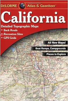
Being the owner of a number of Delorme Atlas & Gazetteer's, I was replacing a worn out Northern California version. This edition, covering all of California is the replacement for both of the older Northern & Southern California Atlas'. Rather than adding more pages, they have changed the scale to fit the maps onto fewer pages. The result is that this is much more like a road atlas, but at two or three times the price. It really is a disappointment. Pretty much every reason I collected them before: the scale, the detail, has disappeared. They also seem to have used their now very old data to produce it. For example, they still show an airstrip in Atwater that has been gone for at least twenty years. Not abandoned, but changed into an industrial area and kart track. Even with GPS maps, there is a market for these atlas & gazetter products, but only if they have at least as much detail as the older versions. Otherwise, get a road atlas. You won't be missing much, and it will probably be more current.
3 Comments
Was this review helpful to you?
Yes No
Sending feedback...
Thank you for your feedback.
If this review is inappropriate, please let us know.
Sorry, we failed to record your vote. Please try again
48 of 55 people found the following review helpful
At first blush this Atlas looks authoritative and promising but it does not bear looking at closely. It is riddled with mistakes. I am an ex-cartographer with many years of experience in the field. I am also a map collector. And I also prefer maps to GPS devices. I find them to be much more fun. But there is no fun in this atlas. I have lived in California all my life and know Southern California like the back of my hand. Though I am not sure what primary sources were used in the making of this atlas, I strongly suspect that Delorme got into trouble using outdated USGS maps.
They also made some very bad decisions in their cartography. For example, they show, in the many urban areas of the map, a myriad of lines spider-webbing all over the place. These are unnamed roads which do the user absolutely no good whatsoever without the names. They clog up the map terribly and Delorme should have forgone this vanity and, instead, shown less roads but named the ones they showed. This is an unforgivable flaw in this atlas. Furthermore, very important information is not shown at all: the full course of a very important road (especially to tourists)--Mulholland Drive--is not shown. A very popular tourist destination and Los Angeles County Park, Devil's Punchbowl, is omitted entirely. Utterly useless place names that haven't been in use in two generations pop up on this map in great abundance adding to the systematic disinformation this shabby product provides. The mistakes are legion--too many to list here. But, to demonstrate their cavalier attitude toward accuracy, I will point out that they have completely omitted an entire intersection on Interstate 15 in the Temecula Valley: Indian Truck Trail.Read more ›
1 Comment
Was this review helpful to you?
Yes No
Sending feedback...
Thank you for your feedback.
If this review is inappropriate, please let us know.
Sorry, we failed to record your vote. Please try again
26 of 29 people found the following review helpful
I was recently the navigator on a 10 day California coast road trip. I ordered the Delorme Atlas to serve as a back-up to my Nuvi GPS. The map is certainly is the better way for looking ahead for rest areas. Half way through the trip, the binding cracked and pages began to fall out. Not good when driving in a convertible with the top down! So I stopped at a Kinko's Copy Center and they replaced the binding with a spiral binding. Now it went from a good atlas to a great atlas! I'm certainly going to do this to any other Delorme atlas I use in the future.
1 Comment
Was this review helpful to you?
Yes No
Sending feedback...
Thank you for your feedback.
If this review is inappropriate, please let us know.
Sorry, we failed to record your vote. Please try again
25 of 29 people found the following review helpful
How can anybody give this product a 5-star rating?? Being a European I ordered this atlas before I went to California, and it looked great at first sight - the only obvious fault was the binding that did not allow it to be put flat on the table when opened. The only acceptable binding for a road atlas is a spiral spine that allows it to open fully and even be turned "inside out" so you can view one page only. This DeLorme atlas is not user friendly - my wife held it on her knees while I was driving, and the binding made it close itself as soon as she took her hands off the book. Moreover the binding soon proved to be of very poor quality as the pages started to fall out after only 4 days, and that was not due to any abuse from us. As tourists we wanted to use minor roads as well as freeways, and we soon got into trouble. The roads listed as Major Connectors or Major Streets in the legend can be anything from paved 4-lane roads in suburbs to the worst gravel roads only accessible by 4-WDs. One example - the "major connector" leading from Rimrock (page 143 B8) up to State Route 18 near Big Bear City should not be attempted by anything else than a high clearance 4wd with an experienced driver at the wheel. How can DeLorme call this dirt track a major connector?? Inaccurate or misleading information was found in many places, for instance a place called Bagdad (page 132 D4). This place is marked as "City or Town" according to the legend, but not a single house was to be seen there. And that was not the only non-existing "town" in that area. Many places of great interest for the tourist were not specially marked, for instance Calico, one of the best preserved ghost towns in California, is only marked as a town and not as a place of interest.Read more ›
Comment
Was this review helpful to you?
Yes No
Sending feedback...
Thank you for your feedback.
If this review is inappropriate, please let us know.
Sorry, we failed to record your vote. Please try again