{"currencyCode":"USD","itemData":[{"priceBreaksMAP":null,"buyingPrice":19.87,"ASIN":"0929591917","isPreorder":0},{"priceBreaksMAP":null,"buyingPrice":19.87,"ASIN":"0929591739","isPreorder":0}],"shippingId":"0929591917::TLuViZrMJ89PhW7IPy72f%2BuHuANDPk6Nw%2B63AOGY7W84ukjozdrfBVeSsTidzWogcTKo%2FGh9j0OJ%2F5Ej6pEsuj62IHuLDu%2FkZrxAd1byh9BKpGMmWg8xtg%3D%3D,0929591739::viEf8r0ArDnh38qNypZyG1sgoeR6wJN1vyNQhIlr6C7ZGlRg%2FknY66xcSwfXxfwstwN5ppuCJblVeWZQtbGXzDVI6IrSeaOOYuR8UfZQ9b8%3D","sprites":{"addToWishlist":["wl_one","wl_two","wl_three"],"addToCart":["s_addToCart","s_addBothToCart","s_add3ToCart"],"preorder":["s_preorderThis","s_preorderBoth","s_preorderAll3"]},"shippingDetails":{"xy":"availability"},"tags":["x","y","z"],"strings":{"showDetails":"Show details","addToWishlist":["Add to Wish List","Add both to Wish List","Add all three to Wish List"],"shippingError":"An error occurred, please try again","differentAvailability":"One of these items ships sooner than the other.","preorder":["Pre-order this item","Pre-order both items","Pre-order all three items"],"addToCart":["Add to Cart","Add both to Cart","Add all three to Cart"],"showDetailsDefault":"Show availability and shipping details","priceLabel":["Price:","Price for both:","Price for all three:"],"hideDetailsDefault":"Hide availability and shipping details","hideDetails":"Hide details"}}
Looking for the Audiobook Edition? Tell us that you'd like this title to be produced as an audiobook, and we'll alert our colleagues at Audible.com. If you are the author or rights holder, let Audible help you produce the audiobook: Learn more at ACX.com.
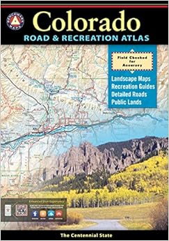
The Right Stuff Of all the requests for information an outdoor writer receives each week, most could have been solved easily if the user only had a map. To that end, we ll suggest the new Colorado Road and Recreation Atlas, a guide that crams an astonishing volume of data between detailed maps, including detailed topographical series of the entire state. Charlie Meyers Outdoor Editor, The Denver Post --The Denver Post
who needs a handheld atlas any more with the maps available on line? THis product will make you rethink that question. The maps are bigger and brighter than anything you can see on line. a truly beautiful atlas.
Comment
Was this review helpful to you?
Yes No
Sending feedback...
Thank you for your feedback.
If this review is inappropriate, please let us know.
Sorry, we failed to record your vote. Please try again
I love a good map because I love to explore and I have traveled all the major roads of the west and many of the back roads. The finest map set I have ever seen are the Benchmark maps for each state. They cover so much detail in an easy to see and read format. Everything comes into easy focus when viewing a section of geography in these Benchmark series of books. I have given some as gifts to people and they tell me they have learned more about their home state from these books that most history books can teach them. Do not leave home without one.
Comment
Was this review helpful to you?
Yes No
Sending feedback...
Thank you for your feedback.
If this review is inappropriate, please let us know.
Sorry, we failed to record your vote. Please try again
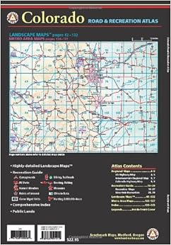
This atlas, like all the Benchmark atlases, is simply perfect and necessary if you ever plan to get off major routes. It gives you all the paved roads in an area, not just the major ones, and the important dirt roads, and, unlike AAA maps, it does a nice job distinguishing between paved and unpaved (nobody's perfect in that regard). If you have googlemaps, get this volume anyway--it gives you a sense of context and overview and allows you to compare alternate routes easily. I use it to guide my cycling, and it's a godsend for finding secondary routes and back roads. It has a very few city insets, but it won't really work as an in-city driving guide. Graphics are excellent--easy on the eyes, very easy to read, pages aren't overloaded with detail. It really has no competition. I use and need googlemaps too, for zooming in for that super-detailed view and for measuring mileages.
Comment
Was this review helpful to you?
Yes No
Sending feedback...
Thank you for your feedback.
If this review is inappropriate, please let us know.
Sorry, we failed to record your vote. Please try again
I really liked the earlier versions of these atlases that showed separate "Landscape" and "Public Lands" sections. The scale can always be smaller, but this was a great companion on our Colorado trip. We were looking for off-highway drives. I prefer to use it instead of or in tandem with a gps or smartphone map.
Comment
Was this review helpful to you?
Yes No
Sending feedback...
Thank you for your feedback.
If this review is inappropriate, please let us know.
Sorry, we failed to record your vote. Please try again
We use this book for cross-country dual sport motorcycling, both planning new routes, and riding them. Because it's large pages give detailed context that a gps screen can't, I carry this book even if I'm following a TAT, CO BDR, or similar GPS track.
As you read the reviews here, notice how often people mention dirt roads, back country travel, camping, etc. The editors here have taken the time not just to put the dirt roads in the right place, they generally identify (with bolder lines, and road numbers) the important dirt roads, the ones that go somewhere. This attention to detail sets this book apart from its competitors (CO Atlas and Gazetteer [red], and the Roads of Colorado [blue] are the others).
Comment
Was this review helpful to you?
Yes No
Sending feedback...
Thank you for your feedback.
If this review is inappropriate, please let us know.
Sorry, we failed to record your vote. Please try again
Compared to the DeLorme Gazetter the backcountry byways in the Benchmark really exist. Even if there are no contour lines the maps are very detailed and good readable. Only the size could be a little more compact. To get a better durability I improved the cover with adhesive water-resistant foil.
Im Gegensatz zu den DeLorme Gazetter stimmen hier auch all die kleineren unbefestigten Straßen. Es gibt zwar keine Höhenlinien, aber die Karten sind dennoch sehr gut lesbar. Einziger Wermutstropfen ist die recht unkompakte Größe. Um die Lebensdauer zu verbessern habe ich den Einband mit selbstklebender Klarsichtfolie versehen.
Comment
Was this review helpful to you?
Yes No
Sending feedback...
Thank you for your feedback.
If this review is inappropriate, please let us know.
Sorry, we failed to record your vote. Please try again