Flip to back
Flip to front

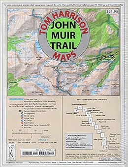
John Muir Trail Map-Pack: Shaded Relief Topo Maps (Tom Harrison Maps) Map – Folded Map, August 8, 2009
$17.05
FREE Shipping on orders over $35.
In Stock.
Ships from and sold by Amazon.com.
Gift-wrap available.
NO_CONTENT_IN_FEATURE
Tell the Publisher!
I'd like to read this book on Kindle
Don't have a Kindle? Get your Kindle here, or download a FREE Kindle Reading App.
I'd like to read this book on Kindle
Don't have a Kindle? Get your Kindle here, or download a FREE Kindle Reading App.

Want to know our Editors' picks for the best books of the month? Browse Best Books of the Month, featuring our favorite new books in more than a dozen categories.
Product Details
Would you like to update product info or give feedback on images?.
|
More About the Author

Discover books, learn about writers, read author blogs, and more.
Customer Reviews
Most Helpful Customer Reviews
35 of 35 people found the following review helpful
By
C. Moon
on January 28, 2009
Format: Map
Verified Purchase
2 Comments
Sending feedback...
I wanted to write this review because I own both this set, and the 'high country' maps (both from Tom Harrison Maps) which cover the same territory. I don't regret owning both, however it is I think worth noting that there is a choice:
The JMT collections featured on this page is a NICE set. It is only ~$18 and includes 13 8x11 maps that are light weight and easy to deal with. On the other hand, they aren't folded and feel somewhat less durable than the high country maps. The scale is not as detailed as the high country maps, but they don't need to be. If you only plan on hiking the JMT, this is a great purchase, but it won't service all your sierra hiking needs (probably obvious, but worth pointing out.)
The following High Country maps cover the same region (Yosemite, Mammoth, Mono Divide, Kings Canyon and Mt. Whitney.) Together, they'd come to around $50 (so $30 more than the JMT set!) To my sense of touch, these maps feel thicker and more durable. Each is folded to the same size (~4"x9")and together have a depth of about three quarters of an inch. For the real survivalist hiking the JMT all at once, the increased weight of these maps (about the equivalent of a light weight paperback book) might be significant. I'm not sure.
What is most definitely significant is the additional coverage and detail on these maps. Once again, if your intention is to enjoy these mountains repeatedly, you'll eventually end up needing the high country maps anyway.
Incidentally, the Tom Harrison maps web page does an excellent job of showing the coverage, but of course, it is hard to compare until you have the maps in your hands. Owning both sets, I would tend to favor the high country maps for their completeness, but in making my plans for part of the JMT trail this summer, I am still not sure which will make it in the backpack.
Thank you for your feedback.
If this review is inappropriate, please let us know.
Sorry, we failed to record your vote. Please try again
20 of 20 people found the following review helpful
By
C. Lotte
on August 4, 2007
Format: Map
1 Comment
Sending feedback...
I've used the same set of Harrison's JMT maps a couple of times now, the first hike took 30 days and second took 18. They're durable, for sure. The scale (1:63,360) is appropriate for the set of 13 8.5"x11" maps - if you really, really hustle you can hike a map per day. The size means you don't have to unfold a huge sheet of paper each time you want to check where you are. The mileage between waypoints on the trail is clearly marked. The maps don't have the detail of 7.5-minute USGS maps but you wouldn't want that kind of detail for this hike. Harrison also has some larger maps, e.g., "Sequoia & King's Canyon Nat'l Parks" with a 1:125,000 scale but the size is inconvenient for the JMT hike. Conceivably you could scissor his larger maps to make a map of the trail but since he's already done the job about perfectly, why bother? (Incidentally the JMT runs between Mt. Whitney and Yosemite's Happy Isles, so being disappointed at not getting a Mexico-to-Canada map doesn't make very much sense.)
Thank you for your feedback.
If this review is inappropriate, please let us know.
Sorry, we failed to record your vote. Please try again
17 of 17 people found the following review helpful
By
C. Justice
on July 4, 2007
Format: Map
Verified Purchase
Comment
Sending feedback...
I purchased this Tom Harrison map set to thru-hike the JMT. At the same time I ordered the maps from the national park service. The T.H. maps are thin, tearproof, waterproof, lightweight and they pack down into a small size. The NPS maps are paper, they tear easily, they'd be damaged easily by water, and because they cover the 3 parks/national forests, rather than just the trail, they are about 10 times as large and heavier. When I go hiking later this year, the T.H. maps are coming with me. The NPS maps are staying at home.
Thank you for your feedback.
If this review is inappropriate, please let us know.
Sorry, we failed to record your vote. Please try again
9 of 9 people found the following review helpful
By
Jonathan Gray
on November 7, 2007
Format: Map
Comment
Sending feedback...
If you are planning on hiking the JMT, buy this! It is EXACTLY what you need and no more.
Thank you for your feedback.
If this review is inappropriate, please let us know.
Sorry, we failed to record your vote. Please try again
6 of 7 people found the following review helpful
By
Earl Hostetter
on May 2, 2007
Format: Map
Comment
Sending feedback...
These set of maps are just what all of us would have created had we the time and technology. They are the perfect companion for the JMT hiker - far better than a standard paper map. Mark them, erase the marks, drop them in water, stuff them in you pack and they're still like new. An excellent product.
Thank you for your feedback.
If this review is inappropriate, please let us know.
Sorry, we failed to record your vote. Please try again
3 of 3 people found the following review helpful
By
and0r
on August 1, 2010
Format: Map
Verified Purchase
Comment
Sending feedback...
this is a GREAT map of the JMT. its durable and well colored and its sectioned out in 1-day hiking segments, plus it has a GPS grid on it.
the only problem is that the map is too focused on the trail. there is very limited coverage of the surrounding areas, so lets say if i wanted to bail out half way through the JMT, i would have trouble finding my way back to civilization.
don't get me wrong, this is the map you need to get, just make sure you also have a broader map of the surrounding area in conjunction with this map.
Thank you for your feedback.
If this review is inappropriate, please let us know.
Sorry, we failed to record your vote. Please try again
3 of 3 people found the following review helpful
By
W. Hegardt
on January 22, 2012
Format: Map
Comment
Sending feedback...
These maps are very good. I did find one case where the distance shown on the map was off by close to 2 miles between Purple and Virginia Lakes. I hiked JMT with these maps. Another fellow brought Erik the Blacks John Muir Trail Atlas available at johnmuirtrailmap.com. I personally preferred the Atlas because all the pages are bound together and it shows campsite locations and other useful info. I'm sure these maps show more of the surrounding area than the atlas however. Both are good choices.
Thank you for your feedback.
If this review is inappropriate, please let us know.
Sorry, we failed to record your vote. Please try again
4 of 5 people found the following review helpful
By
HuaynaPotosi
on May 31, 2008
Format: Map
Verified Purchase
Comment
Sending feedback...
In comparison to the National Geographic Trail illustrated maps Tom Harrison Maps have more user features such as more trail mileage markers and they are slightly more detailed scale. I like the colors of the Natl Geo maps better though. I really like how he's broken his JMT maps into one day's worth of hiking so that you only need one sheet out at a time.
Note this map pack is centered on the JMT if you are looking for other hikes near the JMT or the connector trails to the various trailheads there is very little additional coverage. If you are actually hiking the JMT only they are excellent.
Note this map pack is centered on the JMT if you are looking for other hikes near the JMT or the connector trails to the various trailheads there is very little additional coverage. If you are actually hiking the JMT only they are excellent.
Thank you for your feedback.
If this review is inappropriate, please let us know.
Sorry, we failed to record your vote. Please try again
