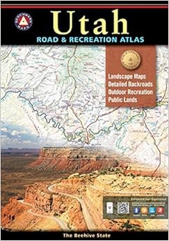
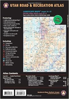
$19.87
FREE Shipping on orders over $35.
In stock but may require an extra 1-2 days to process.
Ships from and sold by Amazon.com.
Gift-wrap available.
{"currencyCode":"USD","itemData":[{"priceBreaksMAP":null,"buyingPrice":19.87,"ASIN":"0929591739","isPreorder":0},{"priceBreaksMAP":null,"buyingPrice":19.87,"ASIN":"0929591917","isPreorder":0}],"shippingId":"0929591739::SxeOARUMMnuIkiQFkMlf4jubCATInMBYUESnbZdTktwyVaAPg2VSorcuCFhHpg8etpQhaJqZai%2FbxJpjgkNnqorCsWOmXY5DIWWFl5xm2TU%3D,0929591917::3tKlyiS5iHf4pIWtcAfWxSOUffG%2FKo5eXg%2BVfriqcv21yEcjq82t9MzaVPAWwddhT1iFz%2FdWeB4h9bCtyykURrabP2WJ5Rm6jh%2BtYX0t8DQJaykUfbSD5w%3D%3D","sprites":{"addToWishlist":["wl_one","wl_two","wl_three"],"addToCart":["s_addToCart","s_addBothToCart","s_add3ToCart"],"preorder":["s_preorderThis","s_preorderBoth","s_preorderAll3"]},"shippingDetails":{"xy":"availability"},"tags":["x","y","z"],"strings":{"showDetails":"Show details","addToWishlist":["Add to Wish List","Add both to Wish List","Add all three to Wish List"],"shippingError":"An error occurred, please try again","differentAvailability":"One of these items ships sooner than the other.","preorder":["Pre-order this item","Pre-order both items","Pre-order all three items"],"addToCart":["Add to Cart","Add both to Cart","Add all three to Cart"],"showDetailsDefault":"Show availability and shipping details","priceLabel":["Price:","Price for both:","Price for all three:"],"hideDetailsDefault":"Hide availability and shipping details","hideDetails":"Hide details"}}
Best Books of the Month
Want to know our Editors' picks for the best books of the month? Browse Best Books of the Month, featuring our favorite new books in more than a dozen categories.
I first tried the Utah Atlas and Gazetteer- it has POOR detail...!, The Gazetter did NOT show many of the back roads (unimproved...), and is not very topographic (mountains...). VERY CONFUSING to try and follow!
I "HIGHLY" recommend the!- Benchmark Utah... Road & Recreation Atlas (any state!) Excellent detail/topographic, and most of the unimproved roads/trails...!
1 Comment
Was this review helpful to you?
Yes No
Sending feedback...
Thank you for your feedback.
If this review is inappropriate, please let us know.
Sorry, we failed to record your vote. Please try again
16 of 17 people found the following review helpful
I used this atlas on a recent trip to Utah in my truck camper. I visited National Parks and back country areas in southern UT. It's excellent for showing the public lands, landscape, and locations of camp grounds.
Comment
Was this review helpful to you?
Yes No
Sending feedback...
Thank you for your feedback.
If this review is inappropriate, please let us know.
Sorry, we failed to record your vote. Please try again
I live in the western US and RV a lot in the summer (and winter now that I'm retired). This is a great book for travelling to sightsee, visit parks, (State & US) or just roam. Get one for each state you plan or hope to visit!
Comment
Was this review helpful to you?
Yes No
Sending feedback...
Thank you for your feedback.
If this review is inappropriate, please let us know.
Sorry, we failed to record your vote. Please try again
I ordered both the Utah and Colorado Road & Recreation Atlases by Benchmark. I am very pleased. These atlases show where the railroads are also. Very good details.
Comment
Was this review helpful to you?
Yes No
Sending feedback...
Thank you for your feedback.
If this review is inappropriate, please let us know.
Sorry, we failed to record your vote. Please try again
I've had a couple map books like this. But this one is better. It really does make travel in the West Desert more fun. Not only does it show roads, but also elevation. The names of different mountains and mountain passes are a given, but this one even gives you the names of many old mines. The detail is excellent.
Comment
Was this review helpful to you?
Yes No
Sending feedback...
Thank you for your feedback.
If this review is inappropriate, please let us know.
Sorry, we failed to record your vote. Please try again
Compared to the DeLorme Gazetter the backcountry byways in the Benchmark really exist. Even if there are no contour lines the maps are very detailed and good readable. Only the size could be a little more compact. To get a better durability I improved the cover with adhesive water-resistant foil.
Im Gegensatz zu den DeLorme Gazetter stimmen hier auch all die kleineren unbefestigten Straßen. Es gibt zwar keine Höhenlinien, aber die Karten sind dennoch sehr gut lesbar. Einziger Wermutstropfen ist die recht unkompakte Größe. Um die Lebensdauer zu verbessern habe ich den Einband mit selbstklebender Klarsichtfolie versehen.
Comment
Was this review helpful to you?
Yes No
Sending feedback...
Thank you for your feedback.
If this review is inappropriate, please let us know.
Sorry, we failed to record your vote. Please try again
These Benchmark maps are the best when offroading in the unknown (and even sometimes in the known!). The maps are generally right on and the trails are numerically marked in conjunction with the state's or BLM's numerical markings. I like that mines and other items of interest are marked on the maps. We dont go offroading without our Benchmark maps, and if we are going to a new state we order that states Benchmark Road and Recreation Atlas.
Comment
Was this review helpful to you?
Yes No
Sending feedback...
Thank you for your feedback.
If this review is inappropriate, please let us know.
Sorry, we failed to record your vote. Please try again