{"currencyCode":"USD","itemData":[{"priceBreaksMAP":null,"buyingPrice":17.05,"ASIN":"0899333257","isPreorder":0},{"priceBreaksMAP":null,"buyingPrice":17.05,"ASIN":"0899333176","isPreorder":0},{"priceBreaksMAP":null,"buyingPrice":17.05,"ASIN":"0899332552","isPreorder":0}],"shippingId":"0899333257::AqU%2Ff%2BwnMwwgQDeEbpboCNmIEOSyc489K0EalipMZK9oDLsU3SGscVHIompG6h4Xpa75590bwKMz53NajpdtyXbMN2x5j2wrOKsT3SWGwec%3D,0899333176::n7YRHH1T0De4EqmyAfPP0KBddrB7hch79PwxBnzb8yWeo8ssil64QOqO172egPnTNnagNz9mnHIHudNeT46Y4c0QouIwURZQavPT7kW4MSU%3D,0899332552::n7YRHH1T0De4EqmyAfPP0GU948aE3OJvPW2Hs%2F9d9latcxRIsP8b1%2FznGzGiAFSmTJEgR4Q38C%2B93wVVguHh%2Fw6piwu5fO0wcGi0rW%2FehZM%3D","sprites":{"addToWishlist":["wl_one","wl_two","wl_three"],"addToCart":["s_addToCart","s_addBothToCart","s_add3ToCart"],"preorder":["s_preorderThis","s_preorderBoth","s_preorderAll3"]},"shippingDetails":{"xz":"same","yz":"same","xy":"same","xyz":"same"},"tags":["x","y","z"],"strings":{"addToWishlist":["Add to Wish List","Add both to Wish List","Add all three to Wish List"],"addToCart":["Add to Cart","Add both to Cart","Add all three to Cart"],"showDetailsDefault":"Show availability and shipping details","shippingError":"An error occurred, please try again","hideDetailsDefault":"Hide availability and shipping details","priceLabel":["Price:","Price for both:","Price for all three:"],"preorder":["Pre-order this item","Pre-order both items","Pre-order all three items"]}}
Best Books of the Month
Want to know our Editors' picks for the best books of the month? Browse Best Books of the Month, featuring our favorite new books in more than a dozen categories.
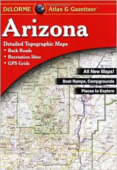
I live in a rural part of southern Arizona, and for many years I always took a copy of this atlas with me while 4 wheeling around the wonderful mountains and deserts. I always recommended it to anyone who spent any time whatsoever traveling. I also have copies of DeLorme's atlases of every western state.
I wore out several copies, and was looking forward to using the latest, 2008 edition, with the wonderful shaded relief and enhanced graphics.
This is not just a disappointment. It is now a dangerous book.
The level of detail is magnificent; too bad it is just plain wrong. Important dirt roads that cross mountain ranges have vanished. New roads, straight as arrows, seem to plow through rugged wilderness areas that have never, and will never, see a road of any kind. The paved county road that connects my small town with the even smaller town 6 miles away has inexplicably vanished.
If you have an older edition, keep it! Preserve it, coat it with vinyl and keep it safe. Because you cannot trust the present edition.
I went out and bought the newest BenchMark maps version of Arizona, and it appears to be correct, and it will be my new guide to getting around. The other DeLorme atlases I own? I cannot trust them, but I have spent too much to merely throw them away. So maybe I'll use them in conjunction with Benchmark atlases. But I'll never be able to trust them alone.
What a shame!
I called up DeLorme, wondering if perhaps, because I live on the border with Mexico, maybe they were cooperating with Homeland Security to confuse immigrants. But they denied it, and said that the level of detail is consistent with other DeLorme atlases. Which means they are probably all equally worthless.
So, once again, DO NOT BUY THIS BOOK! It is dangerous to rely on a map that has gone through the computer blender.
8 Comments
Was this review helpful to you?
Yes No
Sending feedback...
Thank you for your feedback.
If this review is inappropriate, please let us know.
Sorry, we failed to record your vote. Please try again
16 of 17 people found the following review helpful
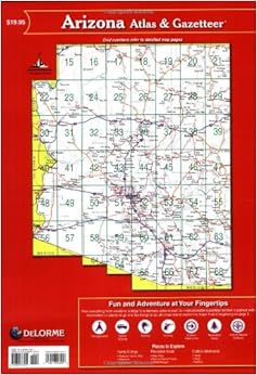
Jack Purcell is pretty thorough in his review. As for the nitpickers, if they really want to get names and numbers of backroads, they can contact the forest service and BLM, as well as the park service, who publishes maps of logging roads, and other limited use roadways. At 1:250,000, who could expect a name or number tag anyway of off-the-beaten trail access roads anyway? What's nice about the new edition is De Lorme has added graphics to note relief, rather than topo lines found on previous editions (Perhaps due to competition from Benchmark Maps). I like the DeLorme Maps because they tend to be more detailed using a smaller resolution overall than other book maps (1:150,000 up to 1:250,000), and if one needs the detail offered in a 7.5 minute map, they have only to visit TopoZone.com to get really close, after locating the general area conditions on a DeLorme Map. A great overall set to obtain, at the very least, get your state and every state that surrounds your own, and exploit it for true getaways and area studies!
Comment
Was this review helpful to you?
Yes No
Sending feedback...
Thank you for your feedback.
If this review is inappropriate, please let us know.
Sorry, we failed to record your vote. Please try again
16 of 17 people found the following review helpful
I used this map when exploring Arizona on two separate occasions. Delorme makes these maps for nearly all states in the US. If you're ever going to explore a state - USE THIS MAP by Delorme. It's well organized, provides information on parks, unique spots like waterfalls, historical sites, etc. You can also find obscure roads not normally seen on tourist maps. I bought the Delorme maps for Colorado, New York, and Virginia as well.
Comment
Was this review helpful to you?
Yes No
Sending feedback...
Thank you for your feedback.
If this review is inappropriate, please let us know.
Sorry, we failed to record your vote. Please try again
15 of 18 people found the following review helpful
So far, having only used this atlas a few times, I have discovered 2 critical errors. While I felt that the map was detailed and the design well done, changes that have been made to roads even before this atlas was published and inaccuracies can be frustrating or even dangerous.
The first problem. This atlas has not been fully updated to reflect changes in roads, even road changes that were made before it was published! For instance, Castle Hot Springs is a place that is north of Lake Pleasant (p. 43 of the atlas). The road to get to it, Castle Hot Springs Road, is a 2-lane, paved road with wide shoulders on either side. If my memory serves me right, this road was there before the atlas was published. According to the DeLorme atlas the roads that go south from the springs and north to it don't even meet- by a margin of three miles! Moreover, the parts of that road they do show indicate that it is no more than a roughly-graded dirt road- not a paved hgihway. Check GoogleEarth if you want to see for yourself.
The second problem. The different "lines" that the DeLorme has used for the roads in this atlas are inconsistent in how they are used. For example, the ride between Prescott and Crown King is pretty rough- no guardrail (sheer drops 100+ feet), unimproved dirt roads, a 4WD vehicle required. Even with an experienced off-road driver, the ride is limited to 5 mph in places and averages only 15-20 mph. However, the atlas shows that the road improves around Goodwin into an improved dirt road. The same kind of line is used on the forest road north of Payson, AZ where you can often go over 40 mph safely. Needless to say, I'm writing this bad review because of that. The road after the place called "Goodwin" was worse in many places.Read more ›
1 Comment
Was this review helpful to you?
Yes No
Sending feedback...
Thank you for your feedback.
If this review is inappropriate, please let us know.
Sorry, we failed to record your vote. Please try again
I have done a lot of backroad/offroad driving in AZ in past 6 years and would not consider going without this book. We find many roads that are not on standard maps. The scale is so much greater and accuracy is unmatched. The only maps that can touch these are USFS maps. I owned several of their Texas Atlases for 25 years while covering the state on canoeing trips for the same reasons and have checked out their New Mexico and Colorado books- same story. They are a bit expensive but well worth the investment if you want to see parts of your area that you didn't know existed.
Comment
Was this review helpful to you?
Yes No
Sending feedback...
Thank you for your feedback.
If this review is inappropriate, please let us know.
Sorry, we failed to record your vote. Please try again