{"currencyCode":"USD","itemData":[{"priceBreaksMAP":null,"buyingPrice":19.62,"ASIN":"0929591984","isPreorder":0},{"priceBreaksMAP":null,"buyingPrice":19.4,"ASIN":"0929591623","isPreorder":0},{"priceBreaksMAP":null,"buyingPrice":19.4,"ASIN":"0929591062","isPreorder":0}],"shippingId":"0929591984::XYLLR%2BJGwNwNil3wLGP1HXKDN85yWUrdH0RNoaYHW0dSdn4SQnuv%2BxJxwFAEIqRsTmR2tvyPRKbgVC7%2F6SJ4nxiz15IqC%2BOOqIR%2Fbgg4Dj8%3D,0929591623::gcW%2FyUScGdF2MGomliVhgl%2F1H4Fjl2PqnHP3ZjH0ORYNei9Noy43xQzIt7HW0njYFUMqRemeAQpzbYaG0nkcyIgI%2BG4IvRrKwFe2ENaAJWuZmIl05U8Fnw%3D%3D,0929591062::ZIW2RD%2B6yXlBNHtYTHq%2BbVkklPUeBCtAkBkGayCt8jTC%2B8u1cnLPH5qm1sgPy9afZ0kCXHhjoRJwEy7FNhLOXz2OsCH50H4td1v3y5kGGwiyYUtzLS1AZA%3D%3D","sprites":{"addToWishlist":["wl_one","wl_two","wl_three"],"addToCart":["s_addToCart","s_addBothToCart","s_add3ToCart"],"preorder":["s_preorderThis","s_preorderBoth","s_preorderAll3"]},"shippingDetails":{"xz":"availability","yz":"same","xy":"availability","xyz":"availability"},"tags":["x","y","z"],"strings":{"showDetails":"Show details","differentAvailabilityAll":"Some of these items ship sooner than the others.","addToWishlist":["Add to Wish List","Add both to Wish List","Add all three to Wish List"],"shippingError":"An error occurred, please try again","differentAvailability":"One of these items ships sooner than the other.","preorder":["Pre-order this item","Pre-order both items","Pre-order all three items"],"addToCart":["Add to Cart","Add both to Cart","Add all three to Cart"],"showDetailsDefault":"Show availability and shipping details","priceLabel":["Price:","Price for both:","Price for all three:"],"hideDetailsDefault":"Hide availability and shipping details","hideDetails":"Hide details"}}
Looking for the Audiobook Edition? Tell us that you'd like this title to be produced as an audiobook, and we'll alert our colleagues at Audible.com. If you are the author or rights holder, let Audible help you produce the audiobook: Learn more at ACX.com.
Product Details
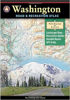
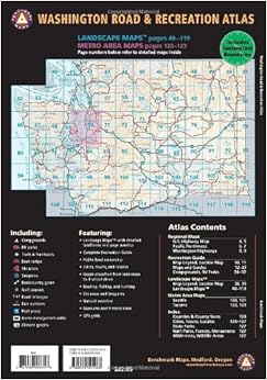
Series: Benchmark Map: Washington Road & Recreation Atlas
The new 4th edition features updated Landscape Maps throughout - field-checked and field verified statewide - with complete back road information. Also, page-to-page overlap and large easy-to-read type. The Recreation Guide has also been thoroughly revised. Categorized listings include campgrounds, RV Parks, Parks, Monuments, and natural wonders, museums and historic sites. Outdoor activity listings include fishing, boating, and hunting areas, river rafting and winter recreation. The Metro map section, with coverage of greater Seattle/Tacoma, has also been updated.
I moved to Washington recently and needed to get some good paper maps of the area. Though I have all the USGS maps of the pacific NW, I find the "landscape" style mapping of these types of maps extremely useful and more up-to-date than many USGS quads. I debated between the well-known Delorme and Benchmark. Benchmark won with better detail, easier to read maps, better recreation details, and the fact they're a Pacific NW company.
This map book has large-format maps for the entire state, US map, a full state map, and a pacific NW map. Map details are complete including roads, "off" roads, trails, mountain elevations, place names, political lines, and others. It also has great sections for recreation (camping, hiking, fishing, local attractions, and others), climate data, and other nice details about the areas. Navigation with GPS is made easy by 7'30" latitude and longitude sections.
I do wish the scale was a little smaller - finding trails and off-the-beaten-path roads can be difficult in particularly busy areas. I also desired more accurate elevation details - the scale seems to clump 8,000' and 14,000' peaks together. Overall, these are excellent maps and should help any outdoor lover find their way.
Comment
Was this review helpful to you?
Yes No
Sending feedback...
Thank you for your feedback.
If this review is inappropriate, please let us know.
Sorry, we failed to record your vote. Please try again
17 of 17 people found the following review helpful
I have purchased both the Washington and Oregon Benchmark Road & Recreation Atlas. These are indispensable if you are going to new places that are off an Interstate Highway. The level of detail is perfect for any outdoors person. Shown are virtually every public campground, forest road, river, stream, and boat launch, and even towns with populations of 50 and less. The editors thought the atlas through so that ANYONE can use it immediately upon receipt. I will never go back to folding maps. An excellent atlas!
Comment
Was this review helpful to you?
Yes No
Sending feedback...
Thank you for your feedback.
If this review is inappropriate, please let us know.
Sorry, we failed to record your vote. Please try again
Just back from vacation - this was great help. I liked having all the campgrounds on there plus seeing where the mountains are etc. Definitely recommend it. Just the size is not very handy...but it doesn't matter too much, if you have it in your car all the time.
Comment
Was this review helpful to you?
Yes No
Sending feedback...
Thank you for your feedback.
If this review is inappropriate, please let us know.
Sorry, we failed to record your vote. Please try again
These Benchmark atlases are much better than their compeitiors. A tip: I take out the staples and then slice (with a sharp knife) the pages apart, taking care to keep them in order. The cover (not separated) acts like a file folder. Then, when I am going camping or traveling in a certain area, I photocopy those section on my color copier. That way, I can write notes on it if I want, and it is much easier to handle in the car and it's certainly easier to carry on a trail. Even if you don't photocopy a section, it is easier to handle the separated pages unless you do all your map reading on the kitchen table. [When I get home, if my copy has surivied the trip, I throw it away, knowing I have the original if I should ever need another.]
Comment
Was this review helpful to you?
Yes No
Sending feedback...
Thank you for your feedback.
If this review is inappropriate, please let us know.
Sorry, we failed to record your vote. Please try again
Some folks complained about receiving an older edition. My atlas is the 2013 Sixth Edition, so no worries as of June 2013. It replaces a 15 year old edition that was finally starting to self destruct through very hard use.
I use these Benchmark altlases for exploring very minor secondary paved and dirt roads when traveling across the state. My gps is hopeless for finding small roads since the detail shifts and turns them off if you back out beyond 0.8 miles scale .... and that scale doesn't show enough of the surrounding area to be at all useful. The atlas shows ALL the roads, even the primitive farm tracks that get you stuck in springtime, and also shows a very large area, so situational awareness ("Where the heck AM I?") is easy to maintain.
I like to use little strips of colored sticky note to mark pages to find them easily later, and also smaller scraps to mark waypoints (intersections) so I can see at a glance on the current map where I next need to turn. It acts sort of like a paper gps but it doesn't get confused..... The sticky paper is easily removed and doesn't damage the map itself.
The Delorme atlases are hopeless. These are great. I gave this book 4 stars because there is still lots of room for improvement.
John Davies Spokane WA USA
Comment
Was this review helpful to you?
Yes No
Sending feedback...
Thank you for your feedback.
If this review is inappropriate, please let us know.
Sorry, we failed to record your vote. Please try again
These are absolutely the best map books around. Easy to find places you want to visit and all the roads and sights along the way. We don't travel without them!
1 Comment
Was this review helpful to you?
Yes No
Sending feedback...
Thank you for your feedback.
If this review is inappropriate, please let us know.
Sorry, we failed to record your vote. Please try again
I was pleasantly surprised to receive the 5th and latest edition of the Washington St. Road and Recreation Atlas. I was perfectly happy with the older 2007 edition, but it got left out in the rain once too often, and unfortunately it's not waterproof. I spend a lot of time exploring the Gifford Pinchot and while this atlas is not a replacement for the more detailed National Forest Service maps from the NPS, it's an invaluable aid for trip planning and getting to the point where the more detailed maps become necessary.
Comment
Was this review helpful to you?
Yes No
Sending feedback...
Thank you for your feedback.
If this review is inappropriate, please let us know.
Sorry, we failed to record your vote. Please try again
Love it! We have an old, similar book from 1995. Too many changes to keep using it. This new one is easy to use, easy to read and has all the info we were looking for.
Comment
Was this review helpful to you?
Yes No
Sending feedback...
Thank you for your feedback.
If this review is inappropriate, please let us know.
Sorry, we failed to record your vote. Please try again