{"currencyCode":"USD","itemData":[{"priceBreaksMAP":null,"buyingPrice":17.05,"ASIN":"0899332536","isPreorder":0},{"priceBreaksMAP":null,"buyingPrice":16.85,"ASIN":"0899332773","isPreorder":0},{"priceBreaksMAP":null,"buyingPrice":17.05,"ASIN":"0899332374","isPreorder":0}],"shippingId":"0899332536::0M1WoHd6bvbPSQE%2BxqR%2BJ0aNCw1TEocQD68nxtOR6r%2FqRv8f7NnVtTWHjV8ZJSjs22suWDM5Vb%2FeJC4S3xlvBXp2MxCflACYcaDU7e2ci%2F4%3D,0899332773::PDZOUFkASyBRQmLMUkE0CqnUxeCgYGPatpfEhweKFyCH5rzDOI0%2B8Q6h%2FR7OQiRxG0DpBAc%2Fa5pMKG%2BesIg5Pfbgp4xiPt%2BGpnh%2BTnsw2Xo%3D,0899332374::teHkpGC67rAxmLk%2BztcTEmxEfr%2F7%2FrZV0MKWt0JUVLxRoLMbTC7Fu44wLGX7gf4BTpNh6G%2FpjEuSoa4GNM6R1PcJMrHxcai7FzFtRVhJqcw%3D","sprites":{"addToWishlist":["wl_one","wl_two","wl_three"],"addToCart":["s_addToCart","s_addBothToCart","s_add3ToCart"],"preorder":["s_preorderThis","s_preorderBoth","s_preorderAll3"]},"shippingDetails":{"xz":"same","yz":"same","xy":"same","xyz":"same"},"tags":["x","y","z"],"strings":{"addToWishlist":["Add to Wish List","Add both to Wish List","Add all three to Wish List"],"addToCart":["Add to Cart","Add both to Cart","Add all three to Cart"],"showDetailsDefault":"Show availability and shipping details","shippingError":"An error occurred, please try again","hideDetailsDefault":"Hide availability and shipping details","priceLabel":["Price:","Price for both:","Price for all three:"],"preorder":["Pre-order this item","Pre-order both items","Pre-order all three items"]}}
Best Books of the Month
Want to know our Editors' picks for the best books of the month? Browse Best Books of the Month, featuring our favorite new books in more than a dozen categories.
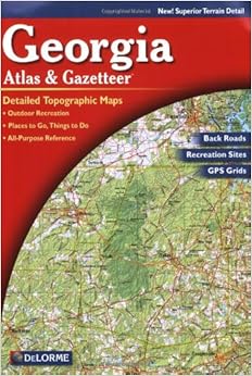
These gazetteer's offer a level of detail in between that of state travel maps and that of detailed county/city maps. They also include topography. They are handy for those traveling to various counties but who lack more detailed maps for each. They won't help much in the city proper, but are useful for finding one's way to various paved county roads. The drawback is that few county roads are labelled with their names on the maps (scale would need to be different for that.)
Comment
Was this review helpful to you?
Yes No
Sending feedback...
Thank you for your feedback.
If this review is inappropriate, please let us know.
Sorry, we failed to record your vote. Please try again
I found the maps useful for detailed travel in a small area. Of course they are MUCH better than the normal road map. Elevation information gives you an idea of what you can expect. My two complaints are: (1)the elevation information is difficult to see -- finding the actual elevation number to go with a line is very hard as there are few numbers and they are not highlighted to make them easier to find; and,(2) additional information about the type of road surface would be helpful for the adventurous.
Comment
Was this review helpful to you?
Yes No
Sending feedback...
Thank you for your feedback.
If this review is inappropriate, please let us know.
Sorry, we failed to record your vote. Please try again
I have numerous other DeLorme Atlases, Utah, Arizona, Florida...and they are all great products. The Georgia version is AWFUL. No detail, the majority of roads are unmarked; very poor execution. When compared to Florida's Atlas, this one looks like a kid drew it up. Don't bother with this one; maybe try Rand McNally or another company.
Comment
Was this review helpful to you?
Yes No
Sending feedback...
Thank you for your feedback.
If this review is inappropriate, please let us know.
Sorry, we failed to record your vote. Please try again
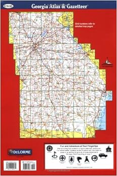
The idea of this format is good but the details on the road level are poor. What I mean by that is secondary roads are shown but not labeled due to size limitations. It's the secondary roads that makes a map worth its paper and ink.
My suggestion is either make the book larger, which may be a physical problem, or increase the page count at the existing size and add useful details. I'd pay a bit more money if I had such a publication.
Comment
Was this review helpful to you?
Yes No
Sending feedback...
Thank you for your feedback.
If this review is inappropriate, please let us know.
Sorry, we failed to record your vote. Please try again
Compared to the other Delorme atlases I have (TX, NC, VA, FL, SC), this one has a lot of roads that have neither numbers or names on them. This meant that when trying to plan a trip in which we would be wandering around back roads looking for places to launch canoes, I went back to Mapquest. Mapquest doesn't have the topo, but at least the roads and rivers were named.
My experience with the VA atlas is that it is fairly accurate. NC has trouble with a bunch of roads that change their name in between two towns, and the Delorme only puts one of the names on the map. I have not had as much experience with FL and SC, but I have so far found them to be accurate.
Comment
Was this review helpful to you?
Yes No
Sending feedback...
Thank you for your feedback.
If this review is inappropriate, please let us know.
Sorry, we failed to record your vote. Please try again
I have bought 8 DeLorme Atlas and Gazetteer atlases and think they are all superb, the best on the market. I use the co-ordinates to locate pin-point spots on the maps!
Comment
Was this review helpful to you?
Yes No
Sending feedback...
Thank you for your feedback.
If this review is inappropriate, please let us know.
Sorry, we failed to record your vote. Please try again
The Gazeteers are unique and very informative if you understand and can read Topographic maps. This is not the best choice for a road map but might just be the best compromise for any outdoor enthusiast looking for very good details in an easy to read and transport atlas. Great for planning backwoods adventures or finding old road alignments in many instances.
Comment
Was this review helpful to you?
Yes No
Sending feedback...
Thank you for your feedback.
If this review is inappropriate, please let us know.
Sorry, we failed to record your vote. Please try again
Very useful and about as accurate as you can get in a print edition, but a recent printing is missing some pages and has doubles of others. Check your copy, especially around pages 16-24.
Comment
Was this review helpful to you?
Yes No
Sending feedback...
Thank you for your feedback.
If this review is inappropriate, please let us know.
Sorry, we failed to record your vote. Please try again