Buy New
$10.76
Qty:1
  • List Price: $11.95
  • Save: $1.19 (10%)
FREE Shipping on orders over $35.
In Stock.
Ships from and sold by Amazon.com.
Gift-wrap available.
Yosemite National Park (N... has been added to your Cart
Have one to sell? Sell on Amazon
Flip to back Flip to front
Listen Playing... Paused   You're listening to a sample of the Audible audio edition.
Learn more
See all 5 images

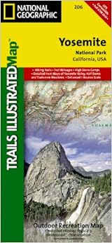
Yosemite National Park (National Geographic Trails Illustrated Map) Map – Folded Map, January 1, 2009


Amazon Price New from Used from
Map, Folded Map, January 1, 2009
"Please retry"
$10.76
$6.48 $7.13
$10.76 FREE Shipping on orders over $35. In Stock. Ships from and sold by Amazon.com. Gift-wrap available.


Frequently Bought Together

Yosemite National Park (National Geographic Trails Illustrated Map) + Top Trails: Yosemite: Must-Do Hikes for Everyone (Top Trails: Must-Do Hikes) + Lonely Planet Yosemite, Sequoia & Kings Canyon National Parks (Travel Guide)
Price for all three: $35.92

Buy the selected items together

NO_CONTENT_IN_FEATURE

Best Books of the Month
Want to know our Editors' picks for the best books of the month? Browse Best Books of the Month, featuring our favorite new books in more than a dozen categories.

Product Details

  • Series: National Geographic Trails Illustrated Map (Book 206)
  • Map: 2 pages
  • Publisher: National Geographic Maps; 2009 edition (January 1, 2009)
  • Language: English
  • ISBN-10: 1566952999
  • ISBN-13: 978-1566952996
  • Product Dimensions: 0.4 x 4.1 x 8.6 inches
  • Shipping Weight: 1 pounds (View shipping rates and policies)
  • Average Customer Review: 4.7 out of 5 stars  See all reviews (26 customer reviews)
  • Amazon Best Sellers Rank: #29,369 in Books (See Top 100 in Books)

Editorial Reviews

About the Author

Founded in 1915 as the Cartographic Group, the first division of the National Geographic Society, National Geographic Maps has been responsible for illustrating the world around us through the art and science of mapmaking.Today, National Geographic Maps continues this mission by creating the world's best wall maps, recreation maps, atlases, and globes which inspire people to care about and explore their world. All proceeds from the sale of National Geographic maps go to support the Society's non-profit mission to increase global understanding and promote conservation of our planet through exploration, research, and education.
Customer Reviews

4.7 out of 5 stars
Share your thoughts with other customers

Most Helpful Customer Reviews

14 of 14 people found the following review helpful By Braden Bills on September 11, 2009
Verified Purchase
Excellent map for all of your hiking and backcountry needs. The newer versions of these maps have the distances of the trails marked which is handy when planning your trips.
Comment Was this review helpful to you? Yes No Sending feedback...
Thank you for your feedback. If this review is inappropriate, please let us know.
Sorry, we failed to record your vote. Please try again
13 of 14 people found the following review helpful By Patrick H. Blythe on September 15, 2008
Verified Purchase
This durable map has terrific detail and is an essential tool for us old-school hikers who don't like using or carrying a GPS unit.
Comment Was this review helpful to you? Yes No Sending feedback...
Thank you for your feedback. If this review is inappropriate, please let us know.
Sorry, we failed to record your vote. Please try again
8 of 8 people found the following review helpful By Amazon Customer on July 26, 2010
Verified Purchase
This is a premium map. It is thick paper that has a substantial feel to it. It includes the park and surrounding areas. otherwise a normal map.
Comment Was this review helpful to you? Yes No Sending feedback...
Thank you for your feedback. If this review is inappropriate, please let us know.
Sorry, we failed to record your vote. Please try again
4 of 5 people found the following review helpful By D.S.Thurlow TOP 100 REVIEWERVINE VOICE on May 3, 2012
Verified Purchase
National Geographic publishes trail maps for many of the National Parks, including the popular Yosemite National Park in the mountains of eastern California. This two-sided map features a multi-color presentation, plastic coating for survival in the field, and enough flexibility to be folded and refolded in various ways.

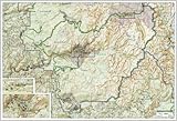
One side shows the southern half of the park, including the southern and western entrances and the high use areas of Yosemite Valley, Tuolumne Meadows, and Mariposa Grove. The scale of the map is 1:80,000; inset maps of the Yosemite Valley and Tuolumne Meadows are at 1:40,000. The reverse side of the map shows the northern half of the park and provides general information on its operations.

The map offers a vivid presentation of countours, roads, trails, and other prominent features. It has sufficient details for driving around the park; it may or may not offer enough detail for hiking and climbing, depending on the experience of the user. "National Geographic"s Yosemite National Park Map" is highly recommended as a planning and travel resource.
1 Comment Was this review helpful to you? Yes No Sending feedback...
Thank you for your feedback. If this review is inappropriate, please let us know.
Sorry, we failed to record your vote. Please try again
1 of 1 people found the following review helpful By J. M. Kazynski on May 11, 2014
Verified Purchase
As an earth scientist, maps are part and parcel of my skill set. And having been formerly employed at Yosemite Nat'l Park and a continued regular visitor, the illustrated trails map was a must have. Having been prepared by National Geographic was icing on the cake.
The map is printed on all weather sturdy stock with great colors and in high detail. I can show my grandchildren the many trails I've hiked and share stories of backpacking from Yosemite to Lake Tahoe.
Viewing the Yosemite high country is awesome and this map provides suitable info for planning a trip and guiding your hikes.
Comment Was this review helpful to you? Yes No Sending feedback...
Thank you for your feedback. If this review is inappropriate, please let us know.
Sorry, we failed to record your vote. Please try again
5 of 7 people found the following review helpful By William A. Llano on February 14, 2010
National Geographic has been publishing specialized maps of The National Parks System, and other natural areas of our country. If you are planning to hike in one of these areas, check and see if they have a map that covers it. They are very useful too if you are just visiting and relaxing. They are very accurate and identify all features. If they are available, I prefer them to the USGS topo maps.
Comment Was this review helpful to you? Yes No Sending feedback...
Thank you for your feedback. If this review is inappropriate, please let us know.
Sorry, we failed to record your vote. Please try again
By D. Millaway on July 11, 2014
Verified Purchase
This is an excellent map if you are not familiar with Yosemite.
Comment Was this review helpful to you? Yes No Sending feedback...
Thank you for your feedback. If this review is inappropriate, please let us know.
Sorry, we failed to record your vote. Please try again
By Viveoistrach on April 25, 2014
Verified Purchase
Love this map. Has everything you need including distances of parts of the trail. Only need this for non valley and backpacker hikes - otherwise you're perfectly good to go with what you get at the entrance.
Comment Was this review helpful to you? Yes No Sending feedback...
Thank you for your feedback. If this review is inappropriate, please let us know.
Sorry, we failed to record your vote. Please try again

Most Recent Customer Reviews