
Flip to back
Flip to front

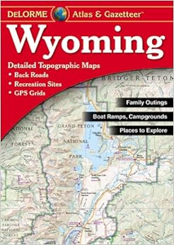
Wyoming Atlas & Gazetteer Map – January 3, 2011
$17.05
FREE Shipping on orders over $35.
In Stock.
Ships from and sold by Amazon.com.
Gift-wrap available.
NO_CONTENT_IN_FEATURE
Tell the Publisher!
I'd like to read this book on Kindle
Don't have a Kindle? Get your Kindle here, or download a FREE Kindle Reading App.
I'd like to read this book on Kindle
Don't have a Kindle? Get your Kindle here, or download a FREE Kindle Reading App.

Want to know our Editors' picks for the best books of the month? Browse Best Books of the Month, featuring our favorite new books in more than a dozen categories.
Product Details
Would you like to update product info or give feedback on images?.
|
Editorial Reviews
About the Author
DeLorme has been directly responsible for many of the major technological advances made in the mapping industry over the past 30 years.
Customer Reviews
Most Helpful Customer Reviews
3 of 3 people found the following review helpful
By
Eric Aros
on April 9, 2009
Verified Purchase
Comment
Sending feedback...
I have purchased these for Wyoming, Arizona, Colorado and Utah so far. They are great to take along on a road trip as they are very detailed and show you where so much is. Elevation, rivers, places to camp etc are just a few of the things in these books. I will continue to buy other states based in the western U.S. as I plan to continue to take road trips.
Thank you for your feedback.
If this review is inappropriate, please let us know.
Sorry, we failed to record your vote. Please try again
2 of 2 people found the following review helpful
By
Ken and Norah Fritz
on January 24, 2009
This is the atlas I recommend for finding back roads and hiking trails. These guides are very detailed because they are written for each individual state. Hawaii's map pages are 1:84,000 scale and parts of Alaska can have 1:1,1,400,000 scale. Visit [...] and you can get information on map scales and elevations for the state you're interested in.
I can thank this book for the best 4th of July I ever had. We live in Washington State. Everyone knows that camping is very crowded over the 4th. It was in this book that I found Lost Lake. It's a small lake tucked into the mountains off highway 12 near Mt. Rainier. Lost Lake is off the beaten path and our atlas showed us the way to get there. Not only did we find Lost Lake but we had a waterfront campsite and I caught my limit of rainbow trout. There are many more lakes that we will explore next summer using this atlas. Visit our blog at [...] - and you can see Lost Lake and the beautiful campsite we found. The book is great for armchair journeys, finding boat launches, streams, and public hunting and fishing grounds. This is great for trip planning and treasuring hunting for the perfect campsite!
Ken Fritz author of The United States Radio Directory: A Traveler's Favorite Companion 2008-2009
Thank you for your feedback.
If this review is inappropriate, please let us know.
Sorry, we failed to record your vote. Please try again
1 of 1 people found the following review helpful
By
A. Meyer
on November 4, 2008
Verified Purchase
Comment
Sending feedback...
This atlas is a must have for going off the paved roads in Wyoming (or really any western state) for both planning and driving.
My only question is; I'm not sure how often they update these books with changes? It would be nice for them to indicate that. Some trails and/or dirt roads seem to have changed some from when these books were published. But over all the detail is good for being that it covers the entire state. There are some local area maps of state and federal lands that show better detail and seem to be more updated.
My only question is; I'm not sure how often they update these books with changes? It would be nice for them to indicate that. Some trails and/or dirt roads seem to have changed some from when these books were published. But over all the detail is good for being that it covers the entire state. There are some local area maps of state and federal lands that show better detail and seem to be more updated.
Thank you for your feedback.
If this review is inappropriate, please let us know.
Sorry, we failed to record your vote. Please try again
1 of 1 people found the following review helpful
By
Phil
on July 4, 2007
Verified Purchase
Comment
Sending feedback...
The Delorme atlases/gazetteers are valuable references especially if you are traveling the back roads. Compared to a regular road map, there is much more detail to find your way just about anywhere in the atlas coverage area. If you need a lot of detail, you can then purchase topographic maps. Special features are also noted. Get one of these for any state where you plan to explore off the beaten trail. I already have atlases for five states, and the collection will surely grow in coming years.
Thank you for your feedback.
If this review is inappropriate, please let us know.
Sorry, we failed to record your vote. Please try again
1 of 1 people found the following review helpful
By
Julie Kay Smithson
on March 29, 2007
Verified Purchase
Comment
Sending feedback...
DeLorme has done it again! Stellar mapping and attention to detail make this a grand publication. Two thumbs up!
Thank you for your feedback.
If this review is inappropriate, please let us know.
Sorry, we failed to record your vote. Please try again
By
Yankee Jane
on July 14, 2014
I'm pretty old school. Like my GPS, Love these Atlases. They are the best for roads, camp grounds, and details.
Thank you for your feedback.
If this review is inappropriate, please let us know.
Sorry, we failed to record your vote. Please try again
By
Shirley Romanek
on February 17, 2014
Verified Purchase
Comment
Sending feedback...
I now have eight Delorme atlases. When we go places, even in my own state, I take the appropriate atlas for our road trips. They not only have detailed roads not on highway maps, but also points of interest, campgrounds, historical places, covered bridges, etc. that make the trip more interesting. If not for the atlas, I would not have known they existed.
Thank you for your feedback.
If this review is inappropriate, please let us know.
Sorry, we failed to record your vote. Please try again
By
Amazon Customer
on February 8, 2014
Verified Purchase
Comment
Sending feedback...
If you are a map lover this is a great one to show you all the little back roads, trails, train tracks etc. I keep it in the car and occasionally explore an area that I didn't know existed before. It has plenty of old towns that are no longer there, but you can find some evidence of once you get there, which is fun.
Thank you for your feedback.
If this review is inappropriate, please let us know.
Sorry, we failed to record your vote. Please try again
