Qty:1
  • List Price: $19.95
  • Save: $2.90 (15%)
FREE Shipping on orders over $35.
In Stock.
Ships from and sold by Amazon.com.
Gift-wrap available.
Wisconsin Atlas and Gazet... has been added to your Cart
FREE Shipping on orders over $35.
Used: Very Good | Details
Sold by Del Sol Inc
Condition: Used: Very Good
Comment: Edition: 12th; light wear
Have one to sell? Sell on Amazon
Flip to back Flip to front
Listen Playing... Paused   You're listening to a sample of the Audible audio edition.
Learn more
See all 2 images

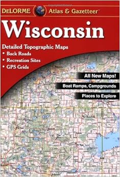
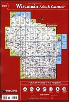
Wisconsin Atlas and Gazetteer Paperback – January 1, 2010


Amazon Price New from Used from
Paperback, January 1, 2010
"Please retry"
$17.05
$12.09 $7.65
$17.05 FREE Shipping on orders over $35. In Stock. Ships from and sold by Amazon.com. Gift-wrap available.


Frequently Bought Together

Wisconsin Atlas and Gazetteer + Minnesota Atlas and Gazetteer (Minnesota Atlas & Gazetteer) + Michigan Atlas & Gazetteer
Price for all three: $51.15

Buy the selected items together

Customers Who Bought This Item Also Bought

NO_CONTENT_IN_FEATURE

Best Books of the Month
Want to know our Editors' picks for the best books of the month? Browse Best Books of the Month, featuring our favorite new books in more than a dozen categories.

Product Details

  • Series: Wisconsin Atlas & Gazetteer
  • Paperback: 96 pages
  • Publisher: DeLorme Publishing; 12th edition (January 1, 2010)
  • Language: English
  • ISBN-10: 0899333311
  • ISBN-13: 978-0899333311
  • Product Dimensions: 15.5 x 10.8 x 0.5 inches
  • Shipping Weight: 2 pounds (View shipping rates and policies)
  • Average Customer Review: 4.5 out of 5 stars  See all reviews (40 customer reviews)
  • Amazon Best Sellers Rank: #57,493 in Books (See Top 100 in Books)

Customer Reviews

Very detailed and accurate.
D. Schultz
The detail is much higher than you find on most other maps, that makes it fun to get off the main roads and find alternate paths!
R. Albrecht
This gazeteer is very useful for planning outdoor trips...canoeing, camping, etc.
Rose Weber

Most Helpful Customer Reviews

5 of 5 people found the following review helpful By Casey A. Niemiec on May 19, 2001
First of all I absolutely love this atlas!! I look at it all the time. Its great for taking a trip through the state because it doesn't leave out a detail (or so it seems until you look harder). It features parks, forests, tourist attractions, natural features, fishing spots and more... The ONLY reason that I give this otherwise 5+ star atlas four stars, is that it has a good amount of missing information. I own the 1989 edition of this book and recently looked at the newest edition (2001) to find that there was NO added information from the old edition. I couldn't find a single difference between the two versions. The problem is, there is probably a couple DOZEN roads within 10 miles of my home that are not listed! I've also found one of their phone numbers for a state park to be the wrong one. Well, they do say to contact them "if you should find conditions other than what is listed in this atlas". So that's what I'll do and I hope to help other people by stepping in and making the right changes. (The changes will be listed in the next edition).
check out Topo USA 4.0. It features up-to-date data for the ENTIRE U.S....
Comment Was this review helpful to you? Yes No Sending feedback...
Thank you for your feedback. If this review is inappropriate, please let us know.
Sorry, we failed to record your vote. Please try again
3 of 3 people found the following review helpful By MAPS345 on May 27, 2013
I have used several Delorme Gazetteers for years and have relied heavily on the Wisconsin version for biking, hiking, driving and geocacheing. I was excited to see the new version out a year or two ago as there have been some significant changes to roads in my area over the past few years and occasionally its been problematic while navigating with the old version that was not up to date on many of these changes. I was very dissappointed to learn they changed the scale on the new version so the detail is actually reduced. Also because of the font style and road lines it is much harder to tell street and city size as well as road and intersection details The mile grid is missing and colors make it look more like a rand map than a detailed topo like I have enjoyed. I am very dissapointed in the new version and I still refer to the old one more frequently because I know it shows all the roads and gives me way more surrounding info than the new one - even if there are some outdated roads. Return to the previous scale and format please.
1 Comment Was this review helpful to you? Yes No Sending feedback...
Thank you for your feedback. If this review is inappropriate, please let us know.
Sorry, we failed to record your vote. Please try again
3 of 4 people found the following review helpful By mlp on April 23, 2010
The old Wisconsin Atlas and Gazetteer (before 2004) actually had better detail and fewer mistakes. The more I use this map, the less I like it. One feature the old version had was a grid showing every square mile in the state. This allowed a person to tell with much greater accuracy when your next turn was coming or the distance between places. This map does not have that. One feature I do like about this map is the slight overlap between pages on the edges of the map, but that is the ONLY thing better about the map. My husband and I have used and do use the Wisconsin Atlas on a very regular basis. Overall I am very dissatisfied with this map and would recommend the older version.
Comment Was this review helpful to you? Yes No Sending feedback...
Thank you for your feedback. If this review is inappropriate, please let us know.
Sorry, we failed to record your vote. Please try again
1 of 1 people found the following review helpful By Doug Erlandson TOP 500 REVIEWER on July 5, 2014
Although I've lived in Nebraska for four decades, I grew up in northern Illinois, and my parents and I frequently vacationed in various parts of Wisconsin. I even went to summer camp for a few summers in a camp near Three Lakes. For the most part we stayed on the state and federal highways and occasionally on the county roads, which did allow us to crisscross the state, with the result that there's no part of Wisconsin I haven't visited. However, a few years ago when my wife and I decided to take a trip to northern Wisconsin and the UP of Michigan, we got a Wisconsin Atlas and Gazetteer. This was truly a boon to our explorations, particularly around the Bayfield area. Not only does this atlas show all the roads, including some that wind around the backwoods and aren't much more than dirt paths, but it also includes all the topographical features, such as creeks, the tiniest of lakes, swamps, and the like. I'm sure we'll be taking this atlas with us the next time we explore Wisconsin.
Comment Was this review helpful to you? Yes No Sending feedback...
Thank you for your feedback. If this review is inappropriate, please let us know.
Sorry, we failed to record your vote. Please try again
3 of 4 people found the following review helpful By Joel D. Schaafsma on May 14, 2010
Verified Purchase
All of the Gazetteer atlas books are always great. I use these for planning scenic motorcycle trips on back roads. Since this edition is pretty dated, I'm concerned that the back roads wont be as accurate as I need them to be.
Comment Was this review helpful to you? Yes No Sending feedback...
Thank you for your feedback. If this review is inappropriate, please let us know.
Sorry, we failed to record your vote. Please try again
This map is the thing to have if you live in Wisconsin and plan on going anywhere outside of your stomping grounds. The backroad details are a great tool if you ever get detoured off of the course that you know. My wife was on her way to work (3o miles away) one morning when a fatality traffic accident rerouted traffic off of the freeway into the windy backroads of southwestern Wisconsin. There was a trooper at some dinky road directing all of the traffic onto it. From that point, there wasn't any help to guide her way to a place she could get back on the road she knows so well. She called me from her cell and I tried to give her a route from what I could find on mapquest until she got too far into the sticks and we lost connection. After a couple of bad guesses on which way to go, eventually she managed to find a county road and made the right decision and got back to the freeway. From that point on, we made sure that one of these is tucked under her car seat not only as insurance for these situations, but as a guide to any time we travel a decent distance. Very detailed and accurate. A must have.
Comment Was this review helpful to you? Yes No Sending feedback...
Thank you for your feedback. If this review is inappropriate, please let us know.
Sorry, we failed to record your vote. Please try again

What Other Items Do Customers Buy After Viewing This Item?