{"currencyCode":"USD","itemData":[{"priceBreaksMAP":null,"buyingPrice":17.05,"ASIN":"0899333478","isPreorder":0},{"priceBreaksMAP":null,"buyingPrice":16.85,"ASIN":"089933329X","isPreorder":0},{"priceBreaksMAP":null,"buyingPrice":22.45,"ASIN":"0899333834","isPreorder":0}],"shippingId":"0899333478::wB95BqKAU9XY6%2FeMvDZBSHUYS9XUeXnZpesge9Xu4nPI8TOfdJCsG1DevRHLzykadUEVDwiLL5TIitD7urkIFP3huC1bg3rE5DwOLMrl5t4%3D,089933329X::8pk0DNQQOABovKzjjD6YkhX0YNPkAly7upcwKqCLBS%2FqaEKpzQ5PTGkaFbpNcCsAPr84vjHwlXFSs4addZneeMRNOzW3%2BT7WhoD6FhAJitM%3D,0899333834::tTocADP7IHO06bRx%2F%2BPiu1bN%2BV6AsBEvV7XDqtCGlXJe4rEwyTTeNJjxJcnut8OupQ33%2FTHqYSw1eT6aJfmjXj2mSjuz10OS%2Bv%2Bl3dwsgvo%3D","sprites":{"addToWishlist":["wl_one","wl_two","wl_three"],"addToCart":["s_addToCart","s_addBothToCart","s_add3ToCart"],"preorder":["s_preorderThis","s_preorderBoth","s_preorderAll3"]},"shippingDetails":{"xz":"same","yz":"same","xy":"same","xyz":"same"},"tags":["x","y","z"],"strings":{"addToWishlist":["Add to Wish List","Add both to Wish List","Add all three to Wish List"],"addToCart":["Add to Cart","Add both to Cart","Add all three to Cart"],"showDetailsDefault":"Show availability and shipping details","shippingError":"An error occurred, please try again","hideDetailsDefault":"Hide availability and shipping details","priceLabel":["Price:","Price for both:","Price for all three:"],"preorder":["Pre-order this item","Pre-order both items","Pre-order all three items"]}}
Best Books of the Month
Want to know our Editors' picks for the best books of the month? Browse Best Books of the Month, featuring our favorite new books in more than a dozen categories.
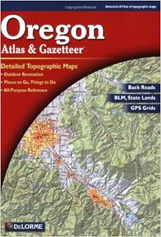
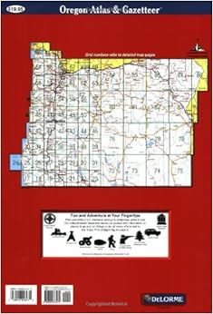
For wilderness travel the Delorme atlases are the best maps I've found to have in your pack aside from a backpack full of USGS and Forest Service maps. If you're interested in a road atlas, something to use while traveling around in the safety of your vehicle, then get a Thomas Guide (the best ROAD atlases in the world). The Delorme atlases show you all the land features, topography, public lands boundaries, and waterways (even the minor and intermittent ones). I've used three of these atlases while traveling on foot through the national forests, and they have literally saved my life many times. Finding locales and navigating inside the map is simple and easy, much simpler than the Benchmark series which don't seem to have a workable navigation key at all. The one and only complaint I have about these atlases are their size; they're huge, and for an atlas whose contents seem to be designed for wilderness travel that large size just sucks when trying to find pack space for it. Fortunately, they fold in half easily, which helps a lot.
Comment
Was this review helpful to you?
Yes No
Sending feedback...
Thank you for your feedback.
If this review is inappropriate, please let us know.
Sorry, we failed to record your vote. Please try again
I had the Benchmark and decided to get a different one as that is getting old. Benchmark is so much better than this Delorme in so many ways I dont know where to start. The organization is so poor, the roads are not differentiated, the rivers and creeks are not dark enough, there is no oregon map as a whole, and there are unnecessary color boundaries that get confused with roads or just become distracting. I still use the old Benchmark all the time.
Comment
Was this review helpful to you?
Yes No
Sending feedback...
Thank you for your feedback.
If this review is inappropriate, please let us know.
Sorry, we failed to record your vote. Please try again
I usually use this atlas in addition to Benchmark's atlas (ISBN-10: 0929591887). While the DeLorme is a good general atlas, I find that the Benchmark tends to be more accurate and shows more obscure goodies like mines and hot springs. Bottom line: If you are going to only own one atlas, get the Benchmark series.
Comment
Was this review helpful to you?
Yes No
Sending feedback...
Thank you for your feedback.
If this review is inappropriate, please let us know.
Sorry, we failed to record your vote. Please try again
I worked on a project with the Oregon DOT, in which I drove about ten thousand miles throughout Oregon in one summer. This map was the guide we used in our travels throughout the state, and it was a more up-to-date source of information than most maps. We had to drive to 160 total sites, half of which were local (county) roads, and we were always able to keep our location, even in some rural areas that were not well marked.
It's the best map you can find on paper, if you're looking for detailed information covering the whole of the state, from interstate highways to dirt roads in the mountains. That is, unless you want to spend a lot more than $20, or you want to print a giant mosaic of the state of Oregon from your printer.
It's not a map for those who are simply looking for street names in cities like Eugene or Portland... there's no 10-page blowup of urban areas in the state, this is a map that covers the STATE of Oregon.
This map is for those who are familiar with the area in which they are traveling. In my work, I did find two roads that were in rougher shape than I would have expected by just looking at the map... however, I was WELL off of highways (making short cuts that took hours off of our trip), and as such, I knew I couldn't expect every single mountain road to be perfectly maintained. By that measure, I found a few roads that were surprisingly well-maintained, given the terrain and vicinity to populated areas. And I found some places that I will hope to take my children camping or hiking someday... thanks to this map.
Remember, there is no substitute for obtaining local information regarding the travel worthy nature of roads. This map is a great guide, but no map is perfect.Read more ›
Comment
Was this review helpful to you?
Yes No
Sending feedback...
Thank you for your feedback.
If this review is inappropriate, please let us know.
Sorry, we failed to record your vote. Please try again
This book is good for anywhere in oregon. When you go into the wilderness it is very good, the only thing better is a forest service map ;) BUY IT if you are planning on living in oregon or like to come to oregon ALL the time.
Comment
Was this review helpful to you?
Yes No
Sending feedback...
Thank you for your feedback.
If this review is inappropriate, please let us know.
Sorry, we failed to record your vote. Please try again
I like this edition more than the last edition. I think the maps are easier to read and the color schemes for various land uses make it easier for me to determine where public land is. The only thing I don't like is that this was published in 2008, so it's already five years old. Considering the previous edition was published in 1998, this edition should have another five years of shelf life before the next edition is released.
If you're a hiker, fisher, hunter, birder or anyone who wants to explore the woods, this is an invaluable resource.
When the smartphone won't work, it's good to have something on paper.
Comment
Was this review helpful to you?
Yes No
Sending feedback...
Thank you for your feedback.
If this review is inappropriate, please let us know.
Sorry, we failed to record your vote. Please try again
My husband and I used this product on a trip to a remote mining operation in Southern Oregon. We also brought along our GPS. Long story short, on the trip down, we used the GPS, which took us on a 10 hour route. On the way home, we compared the GPS route to the atlas, and found a much smarter route which cut 3 hours off of our trip! I love the details and accuracy of this atlas! GPS vs. Atlas Winner: Atlas
Comment
Was this review helpful to you?
Yes No
Sending feedback...
Thank you for your feedback.
If this review is inappropriate, please let us know.
Sorry, we failed to record your vote. Please try again
As with all Delorme Atlas books you get detailed maps of main roads and all back roads. Indispensible if you plan on driving the back roads. Only thing I wish could be improved about these books is their durability. I find the pages typically come loose after what seems like a relatively few number of uses. But I buy them because they give me exactly the detail road maps I need.
Comment
Was this review helpful to you?
Yes No
Sending feedback...
Thank you for your feedback.
If this review is inappropriate, please let us know.
Sorry, we failed to record your vote. Please try again