
Flip to back
Flip to front

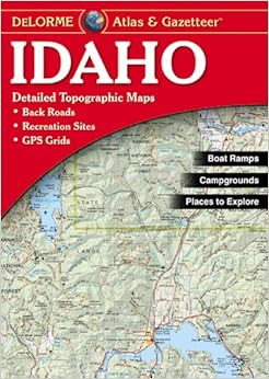
Idaho Atlas & Gazetteer Paperback – June 1, 2010
$17.05
FREE Shipping on orders over $35.
In Stock.
Ships from and sold by Amazon.com.
Gift-wrap available.
NO_CONTENT_IN_FEATURE
Tell the Publisher!
I'd like to read this book on Kindle
Don't have a Kindle? Get your Kindle here, or download a FREE Kindle Reading App.
I'd like to read this book on Kindle
Don't have a Kindle? Get your Kindle here, or download a FREE Kindle Reading App.

Want to know our Editors' picks for the best books of the month? Browse Best Books of the Month, featuring our favorite new books in more than a dozen categories.
Product Details
Would you like to update product info or give feedback on images?.
|
Editorial Reviews
About the Author
DeLorme has been directly responsible for many of the major technological advances made in the mapping industry over the past 30 years.
Customer Reviews
Most Helpful Customer Reviews
11 of 11 people found the following review helpful
By
"pmcmeans"
on November 20, 2002
I use the Delorme Gazetteers, including this one, for planning my fishing trips every year. They include comprehensive coverage of the state in question with sufficient detail to identify all the major topological features one will find, including streams and lakes. Also, they show all the roads. One criticism is that they don't contain road mileages between locations, unlike a highway atlas. But, a highway atlas will not show topographic coutour lines, or indicate locations where one may launch kayaks or rafts, or show locations reputed to have good fishing. I keep a Delorme Gazetteer for each state in which I expect to travel on any extended drive. They enable me to find campgrounds (in the indexes and shown on the maps), roads, topography, and all the essentials to plan a trip.
Thank you for your feedback.
If this review is inappropriate, please let us know.
Sorry, we failed to record your vote. Please try again
15 of 17 people found the following review helpful
By
Dale Hoskisson
on July 30, 2001
Good points: This atlas is the most available and easy to use topographical atlas on the market. It has helped me get into many off-highway areas with great experiences. The roadnames are particularly useful, as these are not on USGS topo maps. Road condition classification also seems to be more accurate than the outdated USGS quads. Bad points: DeLorme gives a false sense of accuracy. On the reverse side of the front cover they advise to measure distance in tenths of miles. No one should pretend to be this accurate at the scale they use. They do explain that the distance will be "slightly" more than measured. On windy roads this could be up to one more mile for every three. My biggest disappointment with the Idaho atlas came after I looked at DeLorme's atlases for Washington and Oregon. Although I have never used them for off-highway travel, it is plain to see that they are better scale, better detail, and there are more features and attractions shown. All the Idaho atlas is is an updated copy of the USGS 1:250K topo maps. Is Idaho not popular enough or what?
Thank you for your feedback.
If this review is inappropriate, please let us know.
Sorry, we failed to record your vote. Please try again
7 of 7 people found the following review helpful
By
Patriot Reader
on September 29, 2009
Verified Purchase
Comment
Sending feedback...
Living in rural Idaho, this guide is a must.
Is it 100% accurate? Well, no.....our roads are often dirt and change frequently, but it's accurate enough for 99.9% of the situations that drivers would put themselves in.
Is it 100% accurate? Well, no.....our roads are often dirt and change frequently, but it's accurate enough for 99.9% of the situations that drivers would put themselves in.
Thank you for your feedback.
If this review is inappropriate, please let us know.
Sorry, we failed to record your vote. Please try again
3 of 3 people found the following review helpful
By
trailweathered
on December 10, 2013
My rating is based heavily on comparisons to other Delorme maps. I am a field biologist and I work throughout many different states in the western USA. I have a stack of Delormes in the back of my truck. Most are great and I would recommend them. This one does not have near the detail of many of the other ones I have used. I think that for a casual user (i.e. someone sticking mostly to main roads, main forest service/blm roads, ect) this map is probably sufficient. Your trouble will come when you leave the proverbial "beaten path" and find that your road or two track is not shown on the map. If you have found it useful for your back-road travels, excellent. It does have some use. I'm simply saying it does not measure up to the level of quality that I have come to expect from Delorme after having used many of their other maps. If you're coming out of state or are unfamiliar with the area in Idaho that you will be traveling I would recommend calling the associated USFS/BLM ranger district with where you will be going and ask which maps you will need to purchase. If they don't have them for purchase in their office they will tell you where to get them, and you won't be spending any more money than you would to buy this.
Thank you for your feedback.
If this review is inappropriate, please let us know.
Sorry, we failed to record your vote. Please try again
3 of 3 people found the following review helpful
By
Happy Camper
on August 1, 2013
I use DeLorme's atlas' for all my trips. If there's one problem I have it's that there's no page carry-over to another spot. There's no forgiveness. In fact, if anything, the page doesn't continue 100%.
I hadn't really noticed that with any other DeLorme's I've owned, and I've got a bunch. I was particularly looking at an area near Lake Stanley. Page 36 shows Lake Stanley right at the top of the chart. Turn to the appropriate page up and you'll see no indication Lake Stanley exists. For anyone looking, I'm talking about 4415°N 11503°W.
Otherwise, I'll always buy and use DeLorme's.
Thank you for your feedback.
If this review is inappropriate, please let us know.
Sorry, we failed to record your vote. Please try again
3 of 3 people found the following review helpful
By
C. Miller
on March 17, 2011
Verified Purchase
Comment
Sending feedback...
Bought this for my son who hopes to live in Idaho some day. It shows all the smaller forestry roads that other maps don't. Gets you in the backcountry and back out again.
Thank you for your feedback.
If this review is inappropriate, please let us know.
Sorry, we failed to record your vote. Please try again
2 of 2 people found the following review helpful
By
J. E. Avena
on January 25, 2008
These Delorme Atlas & Gazetters are wondeful. They show you many features not available through GPS, maps or other atlases. It is a great feature to have the BLM lands marked as well as the back roads. Good resources are also included in each states atlas. A good addition to anyone's travel tools.
Thank you for your feedback.
If this review is inappropriate, please let us know.
Sorry, we failed to record your vote. Please try again
2 of 2 people found the following review helpful
By
Thomas M. DeVange
on March 23, 2014
Verified Purchase
Comment
Sending feedback...
I bought this to help me find campsites, especially remote, primitive ones. The old versions showed many but the new ones don't.
Thank you for your feedback.
If this review is inappropriate, please let us know.
Sorry, we failed to record your vote. Please try again
