{"currencyCode":"USD","itemData":[],"shippingId":"0899332889::,0899333389::QdnYfMNQFxcc29hD%2FD1IKD%2B2eWkQC15tp6qHa9Q%2FVJnJdQ0t1lIb%2FAlKrSWa27pW3ocZYQZQ9nmBM4riqVx9FlsB6%2BEWud0p5rEWPJyCm%2FY%3D,0899332552::QdnYfMNQFxcc29hD%2FD1IKEXhg8HAHHzhr4zYwSRARq98X1miRK%2F9DRxyhb3YDHumLoWf5yfp4jyB4iTN%2BqVJZcQcdM%2FpyzimpibfaLwh39w%3D","sprites":{"addToWishlist":["wl_one","wl_two","wl_three"],"addToCart":["s_addToCart","s_addBothToCart","s_add3ToCart"],"preorder":["s_preorderThis","s_preorderBoth","s_preorderAll3"]},"shippingDetails":{"xz":"sellers","yz":"same","xy":"sellers","xyz":"sellers"},"tags":["x","y","z"],"strings":{"showDetails":"Show details","addToWishlist":["Add to Wish List","Add both to Wish List","Add all three to Wish List"],"addToCart":["Add to Cart","Add both to Cart","Add all three to Cart"],"showDetailsDefault":"Show availability and shipping details","shippingError":"An error occurred, please try again","differentSellers":"These items are shipped from and sold by different sellers.","hideDetailsDefault":"Hide availability and shipping details","priceLabel":["Price:","Price for both:","Price for all three:"],"hideDetails":"Hide details","preorder":["Pre-order this item","Pre-order both items","Pre-order all three items"]}}
Best Books of the Month
Want to know our Editors' picks for the best books of the month? Browse Best Books of the Month, featuring our favorite new books in more than a dozen categories.
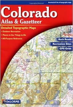
Having just purchased my fourth edition of the DeLorme Colorado Atlas & Gazetteer, I immediately noticed several differences from past editions, all of which make this product an inferior "update" to what had been my mainstay map book for recreation here in Colorado.
First (and worst), the current edition of DeLorme for Colorado does not show all of the public campgrounds -- or even a respectable fraction of them. These are the ubiquitous US Forest Service campgrounds that are sprinkled throughout Colorado's ten national forests, and are a handy (though primitive) camping alternative for hundreds of thousands of residents and visitors each year. Past editions of the Colorado Atlas and Gazetteer showed each and every USFS public campground, which meant that all the info I needed short of consulting a USFS National Forest-specific map was in one place: DeLorme. Now, however, the DeLorme map book shows maybe one out of every three or four -- which probably is worse than showing none at all. It is not omitting ALL USFS campgrounds; it is woefully INACCURATE in what it does show. This from an "atlas"?
Second, the new map book has so exaggerated the width of roads and over-emphasized place names that it looks like a cartoon of its former self. It is more difficult to read, and is almost deceptive in its scale of road size to the scale of the actual map. Further, by exaggerating road widths, it now has to sacrifice detail and accuracy anywhere neighborhoods appear, particularly in mountain areas. So, again, it is no longer adequate as my only map source when traveling to those areas.
Third, the "new and not improved" DeLorme has made the blue lines and lettering of stream and lake names even more difficult to read than before (and they were elusive in past editions).Read more ›
1 Comment
Was this review helpful to you?
Yes No
Sending feedback...
Thank you for your feedback.
If this review is inappropriate, please let us know.
Sorry, we failed to record your vote. Please try again
28 of 29 people found the following review helpful
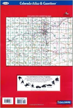
You should receive the sixth edition (2002) of the DeLorme Colorado Atlas & Gazetteer when you order from Amazon, even though Amazon's listing still shows only the fifth edition (2000). The atlas is indispensable if you're planning to travel on the back roads or the major Forest Service or BLM roads of Colorado. Governmental jurisdictions are well-differentiated by color, and the topographic relief is very nice. The only caveat is that the scale of the maps in this atlas, at 1:160,000, is too large to show great detail. If you're mountain biking or hiking in remote terrain or on minor trails, you should get additional maps, such as smaller-scale governmental maps or those made by Latitude 40.
Comment
Was this review helpful to you?
Yes No
Sending feedback...
Thank you for your feedback.
If this review is inappropriate, please let us know.
Sorry, we failed to record your vote. Please try again
I used the previous version of the Gazetteer for the past 13 years, and have found this version to not be as useful. I should mention that I need to know where public lands boundaries are, and these were much better delineated in the previous version. Otherwise, the major public roads appear up-to-date, but there could be improvements for unimproved roads on public lands.
Comment
Was this review helpful to you?
Yes No
Sending feedback...
Thank you for your feedback.
If this review is inappropriate, please let us know.
Sorry, we failed to record your vote. Please try again
This map is awesome. My wife and I use it when out in the mountains off-roading. It's great to have something we can use to navigate without any cell service. We've been able to find ourselves in the boonies and get back to a main road a couple times using this. If you like to get off the beaten path, I would strongly recommend a map like this.
Comment
Was this review helpful to you?
Yes No
Sending feedback...
Thank you for your feedback.
If this review is inappropriate, please let us know.
Sorry, we failed to record your vote. Please try again
We are planning a trip to Colorado that will include getting into so-called "back" areas, off the beaten track in order to do some hiking, camping, birding, etc., and needed an Atlas that is detailed enough to show county and town roads, unpaved as well as paved roads, and secondary roads through public lands. The Delorme Atlas and Gazetteer accurately provides that detail, allowing you to get into and back out of out-of-the-way places. We have used these Atlases in other states, and although it is possible that the maps may contain dated, inaccurate information on some back roads, we have yet to get lost! This is a great tool for determining how to get places when standard road atlases do not provide the detail to be helpful .
Atlas was delivered in a timely manner and was well packaged. Very pleased with this Amazon interaction.
Comment
Was this review helpful to you?
Yes No
Sending feedback...
Thank you for your feedback.
If this review is inappropriate, please let us know.
Sorry, we failed to record your vote. Please try again
Although I have not looked at Benchmark's Colorado atlas to compare this atlas with that one, I used this atlas for a week and a half trip with a lot of backcountry driving & hiking last summer & was quite pleased. There is more detail here than in the DeLorme atlases I have used for Arizona & New Mexico, and all roads on my route appeared to be correctly labelled and located. I only encountered one problem: Forest Service roads at high elevation (ca. 11,000 feet and above) are snowy and impassable in June (at least, they were last year!). Perhaps this is obvious to anyone familiar with Colorado, but driving up from New Mexico (where I have yet to find a road impassable from snow) it was a bit of a surprise, and it would be nice if these high passes were marked as impassable from winter to early summer. That detail aside, the atlas worked perfectly for me.
Comment
Was this review helpful to you?
Yes No
Sending feedback...
Thank you for your feedback.
If this review is inappropriate, please let us know.
Sorry, we failed to record your vote. Please try again